Los Angeles 10-Day Temperature & Rainfall Outlook
Plan your daily commute, coastal visits, or outdoor trips across Greater Los Angeles with our extended 10-day meteorological forecast.
Because Southern California's microclimates cause temperatures to vary significantly between coastal areas (like Santa Monica) and inland valleys (like Pasadena), tracking extended trends helps you prepare for shifting conditions throughout the region.
🌡️ Temperature Trend
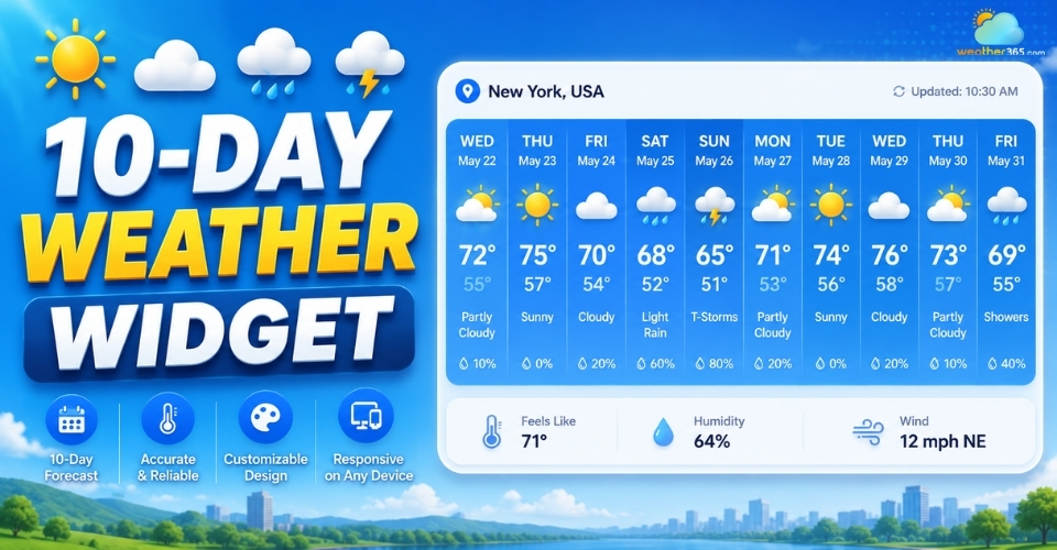
Over the next 10 days, daytime high temperatures across Los Angeles are projected to average between 51°F and 64°F.
Coastal vs. Inland Dynamic: Expect cooler, breezier conditions near the Pacific beaches due to the coastal marine layer, while inland valleys may feel 10°F to 15°F warmer during peak afternoon hours.
Daily Temperature Swings: Mornings and evenings will stay comfortable, but afternoon solar heating will cause noticeable temperature spikes. Wearing layered clothing is recommended if you are transitioning between coastal and valley neighborhoods.
🌧️ Rainfall Outlook
Rain chances will about 100% over the 10-day period, with the highest chance of rain expected on Thursday.
A higher precipitation percentage indicates greater likelihood of rainfall across the basin, not necessarily heavy downpours.
Rain can quickly impact traffic on major corridors like the I-5 and I-405. If you are planning outdoor sightseeing at Griffith Observatory or trip days to Venice Beach, prioritize days with lower rain probabilities.
📅 Use the 10-Day Forecast to Plan Ahead
Forecast accuracy naturally decreases further into the 10-day window.
We recommend using this 10-day trend for general planning and checking our Hourly Forecast 24 to 48 hours prior to your planned events for real-time adjustments.
Data & Verification Note: Weather data updated automatically every hour from National Oceanic and Atmospheric Administration (NOAA) & National Weather Service (NWS) feeds. Reviewed by our meteorology team.
Extreme Weather Patterns in Los Angeles
By Weather365 Meteorological Team | Medically & Technically Reviewed by NWS Los Angeles Data Feeds | Updated: September 2026
Los Angeles is renowned for its mild Mediterranean climate, yet its unique topography - spanning coastal basins, dense urban corridors, and steep mountain ranges creates microclimates prone to high-impact weather hazards.
Based on historical data from the National Weather Service (NWS) Oxnard/Los Angeles and NOAA, the region faces four primary meteorological threats each year.
1. Extreme Heat Waves & Microclimate Variations
While coastal communities like Santa Monica benefit from marine layer cooling, inland basins such as the San Fernando and San Gabriel Valleys frequently experience temperature spikes exceeding 100°F (38°C) during summer heatwaves.
Health & Safety Tip: Stay hydrated, avoid outdoor activities between 11:00 AM and 4:00 PM, and utilize local cooling centers designated by Los Angeles County Public Health.
2. Santa Ana Winds & Wildfire Risks
During autumn and winter, high-pressure systems over the Great Basin force offshore gusty winds known as Santa Ana Winds.
Passing through narrow mountain passes, these winds accelerate, drop relative humidity below 10%, and rapidly dry out chaparral vegetation.
Red Flag Warnings: Issued when gale-force gusts combined with dry vegetation elevate fire spread risks.
Major corridors like the San Gabriel Mountains and Malibu coastal bluffs require heightened vigilance and readiness for immediate evacuation orders from Cal Fire.
3. Atmospheric Rivers & Flash Flooding
During winter storm cycles, Atmospheric Rivers, plumes of dense Pacific moisture can dump inches of rain within hours.
Burn Scar Risks: Steep mountain terrain and recent wildfire burn scars (such as those in the Angeles National Forest) are exceptionally vulnerable to rapid mudslides, debris flows, and flash floods that disrupt major thoroughfares like I-5 and PCH (Pacific Coast Highway).