




Severe Thunderstorm Watch for NYC: Damaging Winds & Flash Floods Possible


A severe thunderstorm watch was issued by the National Weather Service’s Storm Prediction Center at 2:10 p.m. EDT Monday, August 10, for New York City and much of the Tri-State area through 9 p.m. Strong storms are expected mainly after 5 p.m., with damaging winds, heavy rain, frequent lightning, and localized flash flooding possible. Monitor updated forecasts and radar information to stay safe!
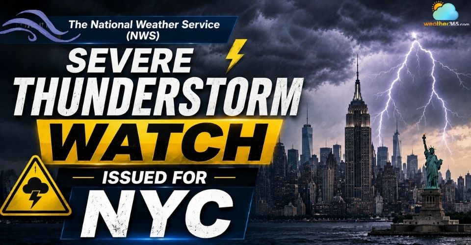
Severe thunderstorm watch is issued for NYC
- Severe Thunderstorm Watch Issued for NYC
- Strong Winds, Heavy Rain and Lightning Pose Risks Across NYC
- Storms Are Expected To Impact NYC From Afternoon Through Evening
- Atmospheric Conditions Are Supporting Strong Thunderstorm Development
- NYC Officials Urge Residents To Prepare Before Severe Weather Arrives
Severe Thunderstorm Watch Issued for NYC
A severe thunderstorm watch was issued by the National Weather Service (NWS) Storm Prediction Center at 2:10 p.m. EDT Monday, August 10, covering New York City and parts of the Tri-State area.
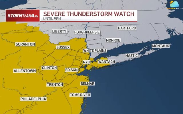
The National Weather Service issued a severe thunderstorm watch for NYC
Source: NBC New York
The watch remained in effect through 9 p.m. EDT, with the greatest thunderstorm risk expected from the late afternoon into the evening.
The alert came as forecasters warned of damaging wind gusts, heavy downpours, frequent lightning and localized flash flooding.
The NWS New York office said thunderstorms were possible late Monday afternoon and evening, with wind gusts above 35 knots (about 40 mph) possible in the strongest storms.
Check the latest severe weather watch for your location here!
Strong Winds, Heavy Rain and Lightning Pose Risks Across NYC
The strongest storms could bring several hazards to New York City, with damaging winds, torrential rain and frequent lightning among the main concerns identified by forecasters.
The National Weather Service warned that some thunderstorms could produce wind gusts above 35 knots, or about 40 mph, along with locally heavy downpours.
Damaging winds could be particularly disruptive across the city. Strong gusts may bring down tree limbs and create scattered power outages.
They can also make conditions hazardous for people outdoors and for vehicles on exposed roads and bridges.
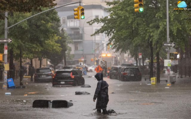
Damaging winds, torrential rain, and frequent lightning are expected
Patch identified strong winds as one of the primary severe-weather threats for Monday.
Stay safe with High winds safety tips
Heavy rain is another concern, especially where thunderstorms produce intense downpours over a short period.
The National Weather Service warned that these storms could lead to localized flash flooding.
Urban areas and places with poor drainage are especially vulnerable when rainfall overwhelms drainage systems.
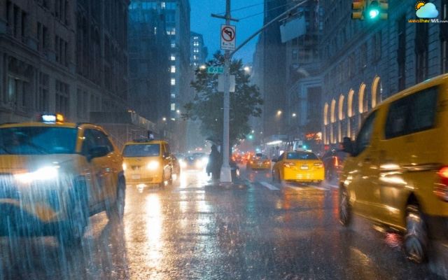
Heavy storms can lead to localized flooding
Frequent lightning will add another hazard as thunderstorms develop.
Dangers of lightning can strike well outside the heaviest rainfall, making outdoor activities unsafe even when rain is not falling directly overhead.
Forecasters also identified hail as a possible threat with the strongest storms.
Storms Are Expected To Impact NYC From Afternoon Through Evening
The storm threat is expected to build through Monday afternoon, with the most active period arriving after 5 p.m. and continuing into the evening.
The timeline below follows the latest forecast from the National Weather Service and local weather reports.
Monday, 2–5 p.m.: Scattered showers or thunderstorms may develop as conditions become increasingly unsettled.
After 5 p.m.: The main storm window begins. Stronger thunderstorms become possible, with damaging winds and heavy rain posing the greatest concerns. The timing could also affect the evening commute.
Monday evening through 9 p.m.: Storms may remain scattered, with periods of heavy rain and thunderstorms possible while the Severe Thunderstorm Watch remains in effect.
After 9 p.m.: The watch is expected to expire unless extended. Storm activity should gradually decrease as the system moves away.
Early Tuesday: The storm system is expected to move out, with weather conditions becoming more stable across NYC.
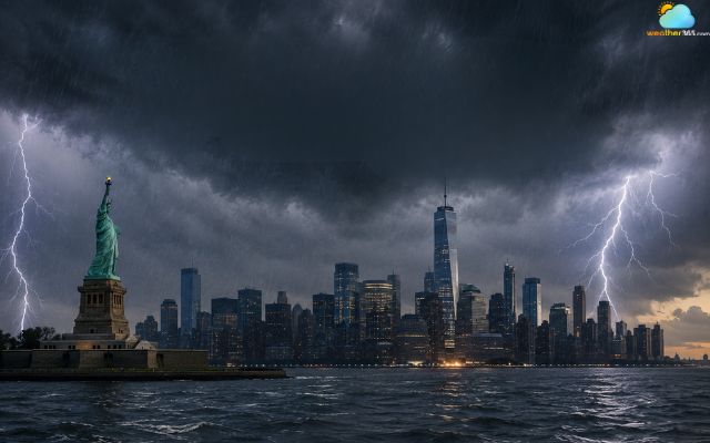
Storm threat is expected to build through Monday afternoon
Atmospheric Conditions Are Supporting Strong Thunderstorm Development
A surge of heat and humidity is helping create an unstable atmosphere across the NYC area.
New York City had seen several days of above-average heat, with daytime temperatures reaching around 90°F (32°C) or higher in parts of the city.
The National Weather Service (NWS) forecast highs in the upper 80s to low 90s, with heat index values reaching the upper 90s. A Heat Advisory remained in effect for the region through 7 p.m. Monday.
The hot conditions are part of a broader heat wave across the eastern US. However, the NYC setup is not simply about high temperatures.
A warm, humid air mass is providing moisture and instability, while an approaching weather disturbance is helping thunderstorms develop.
NWS New York noted that the combination of warm, humid air and an incoming disturbance would support strong to severe thunderstorms across the region.
Learn more on: What causes thunderstorms?
The unsettled setup also increases the potential for locally intense rainfall and strong wind gusts.
For NYC, this creates a sharp contrast between the daytime heat and the developing storm environment.
Temperatures remain high, while increasing atmospheric instability gives thunderstorms more energy to strengthen.

Heat and humidity create an unstable atmosphere in NYC
NYC Officials Urge Residents To Prepare Before Severe Weather Arrives
New York City officials are urging residents to stay alert as severe thunderstorms threaten the area.
NYC Emergency Management (NYCEM) advises New Yorkers to monitor official weather alerts and be prepared for rapidly changing conditions.
Follow these steps to stay safe:
Before storms: Secure loose outdoor items, charge phones and monitor updates from the NWS and NYCEM.
For flooding: Keep nearby catch basins clear of leaves and debris where it is safe to do so. Avoid areas prone to flooding.
During thunderstorms: Move indoors and stay away from windows. Do not shelter under trees or in open areas.
If flooding occurs: Never walk or drive through flooded streets. Water can hide hazards and rapidly become deeper.
Stay informed: Follow official alerts from the National Weather Service, NYC Emergency Management and Notify NYC for changes to the weather situation.
The NWS New York office also recommends having a way to receive weather warnings while storms are nearby.
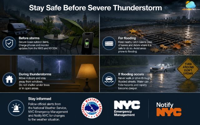
NYC residents are advised to stay alert
References
- NBC New York
- NYCEM Weather Updates
- Silive
Related post
What Causes Thunderstorms? Explore the Science Behind Intense Events
 1586
1586
 8
8
 4.8
4.8
 15/09/2026
How To Survive a Thunderstorm: Essential Survival Tips for Your Safety
1212
8
4.7
15/09/2026
Thunderstorm in DC With 60 MPH Gusts Leaves Thousands Without Power
231
0
4.9
12/06/2026

0 Comment
Leave a comment
Your email address will not be published. Required fields are marked *