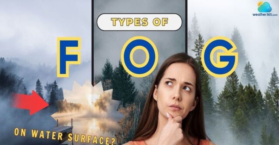
7 Common Types of Fog and What Makes Each One Unique
Do you know that there are many different types of fog, each with its own cause and appearance? That’s exactly the reason why fog looks different from place to place! In this guide, we will help you understand the 7 main types of fog, how to identify and stay safe when visibility drops.
How many types of fog?
Why are there different types of fog?
Fog is simply a cloud that forms at ground level, but one fact about fog is that not all fog develops the same way.
Fog forms when water vapor condenses into tiny droplets suspended in the air, usually when the temperature cools to the dew point.
However, the mechanism of cooling, location, and moisture source differ, and leading to several distinct types of fog.
-
When the ground loses heat overnight, you get radiation fog.
-
When arm, moist air moves over a cold surface, advection fog forms
-
In valleys, on hillsides, over lakes, or in freezing Arctic conditions, other special forms of fog develop under specific conditions.
Fog is categorized into 7 main types: Radiation fog, advection fog, unslope fog, steam fog, frontal fog, ice fog, and freeze fog.
Now let’s break down each type one by one.
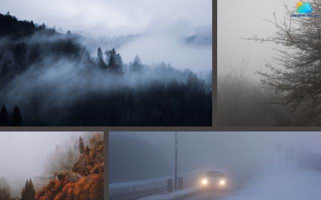
There are many different types of fog
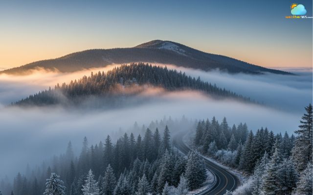
Radiation fog (ground or valley fog)
Radiation fog is one of the most common and visually familiar types of fog.
It typically forms on clear nights with light winds, when the ground rapidly loses heat through radiation after sunset.
As the ground cools, the air directly above it cools too, and if the temperature drops to the dew point, fog begins to form near the surface.
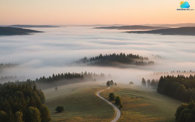
Radiation fog is one of the most common types of fog
This kind of fog is often seen in valleys, open fields, and low-lying rural areas, where cool air tends to settle.
It’s sometimes called valley fog because it hugs the ground and can last for hours after sunrise, until the sun warms the ground enough to evaporate it.
Radiation fog has several notable features like:
-
Appears during calm, clear nights
-
Thickest before sunrise
-
Quickly dissipates after the sun rises
-
Common in autumn and winter
To stay safe, slow down and use low-beam headlights when driving through radiation fog.
Maintain extra distance from other vehicles, and avoid high beams, which reduce visibility. If walking or cycling, wear reflective clothing to stay visible.
Learn more safety tips on How to drive in fog!
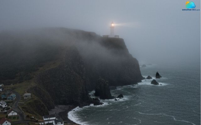
Advection fog
Advection fog forms when warm, moist air moves (advects) over a cooler surface, such as cold ocean water or a snow-covered ground.
The air cools as it travels, reaching its dew point and creating a thick, widespread fog layer.
This is one of the types of fog most often associated with coastal areas, especially places like San Francisco, where warm Pacific air meets the cold California Current.
According to the National Weather Service, advection fog can persist for days if winds keep pushing warm air over cooler surfaces.
Advection fog forms when warm, moist air moves over a cooler surface
Advection fog often occurs along coastlines like California, Newfoundland, and Chile where warm, moist air from the ocean meets colder water regions.
It also forms over cold ocean currents and during transitional seasons when there are significant temperature changes.
Mariners should be especially cautious; fog horns, radar, and GPS are essential when boating in fog caused by advection.
On land, if driving through coastal areas, expect limited visibility even during daylight.
Unslope fog (Cheyenne/Hill fog)
Unslope fog forms when moist air is forced to rise along sloping terrain. As the air climbs, it expands and cools. If it cools to its dew point, water vapor condenses into tiny droplets and a layer of fog appears.
Meteorologists usually call this phenomenon upslope fog, but many local names exist, such as Cheyenne fog or hill fog.
Upslope fog often sticks to the windward side of elevated terrain. It can extend hundreds of meters above the ground.
Unlike shallow radiation fog, it may persist as long as the wind continues to push moist air uphill.
Upslope fog often sticks to the windward side of elevated terrain
Visibility can also change quickly with unslope fog’s altitude: clear at the valley floor, dense a few hundred meters higher. Winds that create the fog can be moderate to strong, so the fog can stay in place even with breezy conditions.
Typical places to see upslope fog are mountain ranges and plateaus where moist air flows onshore or across plains and then encounters rising ground.
For example, moist Atlantic air flowing toward the eastern slopes of the Rockies or moist maritime air pushed against coastal hills often produces this fog.
Remember to reduce speed on slopes or mountain roads where upslope fog forms. Use fog lights and keep a safe following distance.
Hikers should carry navigation aids and avoid ridge crossings in low visibility.
Steam fog (arctic sea smoke/ Evaporation fog)
Steam fog occurs when cold air moves over a warmer water surface, causing moisture to evaporate into the cold air and immediately condense into fog.
In other words, the cold air can’t hold the moisture, so it turns back into tiny droplets right above the water.
This is why steam fog often looks like wisps of steam or smoke rising from a lake or river.
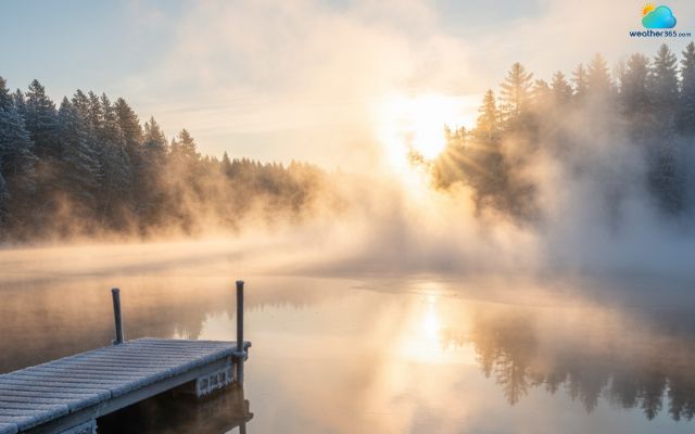
Steam fog often stays close to the water surface
The key to its formation lies in temperature contrast and mixing. Warm water evaporates moisture into the air above.
When that warm, moist layer meets much colder air, the water vapor supersaturates and condenses into droplets.
Because the mixing is limited by a strong inversion (warmer air above colder air), the fog layer stays shallow but dense.
Some characteristic features distinguish steam fog:
-
Typically stays close to the water surface and is shallow in depth.
-
Often forms columns or wisps, giving it a smoky or steamy look.
-
Because it forms only where cold air flows over warmer water, it doesn’t usually extend far inland.
-
Its visibility is often very low, sometimes down to a few hundred meters.
You will most often see steam fog in cold to temperate climates where water bodies remain relatively warm as the air cools. For example:
-
Over lakes or rivers in autumn or early winter, when water has not yet cooled but the air temperature drops sharply.
-
In northern latitudes or polar regions, cold air flows over patches of open water in sea ice, producing arctic sea smoke.
-
Coastal areas, where steep slopes and cool ambient air cause steam fog to drift over land.
Proceed cautiously near rivers, lakes, or warm water surfaces where steam fog occurs.
Use low-beam headlights and be alert for sudden patches of dense fog. While boating in fog, you should rely on GPS or radar to navigate safely.
Frontal fog (Precipitation Fog)
Frontal fog develops in connection with weather fronts, especially warm fronts, though cold-front or frontal-passage fog can also occur.
As precipitation falls from a warmer air layer into cooler air below, some of the rain evaporates, adding moisture to that cooler air near the surface.
This raises its dew point and can push it toward saturation. Once saturated, condensation occurs and fog forms.
Key features of frontal fog include:
-
It tends to cover large areas, because frontal zones can stretch over hundreds of kilometers.
-
It often coexists with light rain or drizzle, making it hard to distinguish from precipitation alone.
-
It can last several hours to a day or more, depending on how long the moist precipitation continues and how stable the lower-air layer is.
-
Visibility in frontal fog can drop to very low values, especially when precipitation and fog mix.
-
The fog often appears first before the frontal system fully arrives (in the warm sector) or lingers after in its wake.
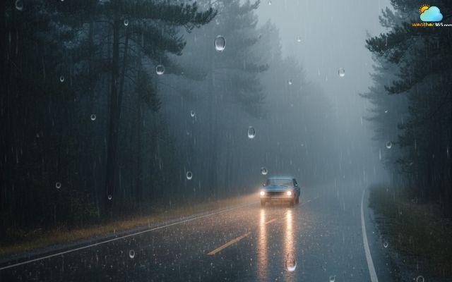
Frontal fog often covers large areas and can persist for hours
Where does frontal fog often occur? A classic example is regions affected by warm fronts sweeping in from oceanic or maritime air masses toward a landmass.
For instance, in the eastern United States during winter or spring, a warm moist air mass moving from the Gulf of Mexico can bring frontal fog as it meets cooler continental air.
Frontal fog is also common in mid-latitude climates with frequent frontal systems.
How to stay safe in this type of fog? Check weather forecasts for incoming fronts that may bring fog and drizzle.
Drive slowly, use fog lights, and avoid cruise control in wet, foggy conditions. Be ready for patches of reduced visibility along the route.
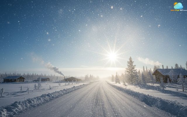
Ice fog
Ice fog is a special type of fog, made up of tiny ice crystals floating close to the surface. It is not composed of liquid water droplets, but of ice particles.
Unlike regular fog, the moisture here has already frozen in the air.
Ice fog usually forms under extreme cold conditions, often well below −10 °C (14 °F).
In those frigid settings, water vapor in the air may sublimate directly into ice crystals rather than condense first as liquid. In other words, moisture goes from vapor to ice without ever being liquid.
Another pathway is when supercooled droplets (liquid water droplets colder than freezing) finally freeze due to cooling or contact with ice-nucleating particles.
But pure ice-fog formation mostly happens in very cold, calm air where the ambient conditions support ice crystal stability.
Ice fog can interfere with aircraft surfaces and making navigation very risky
Distinctive features of ice fog:
-
The particles are solid ice crystals, not liquid droplets.
-
Visibility can be very low, similar to dense liquid-fog, especially when the ice crystals are abundant.
-
It often appears in shallow layers, sometimes so thin that from higher vantage you may see through to the ground.
-
In daylight, ice fog may sparkle or shimmer as ice crystals refract light.
-
Because ice crystals are lighter and more crystalline than droplets, ice fog can appear more delicate or “crystalline” in texture.
Ice fog is rare and confined to polar, Arctic, or very cold continental regions.
For example, in interior Alaska or in parts of Siberia during deep winter, when temperatures plunge and moisture from exhaust, open water, or localized sources is available, ice fog can develop.
In some cold cities, emissions (from heating, vehicles, industry) may provide the moisture needed to trigger or sustain ice fog under suitable cold, calm conditions.
The phenomenon is most likely in areas with persistent frigid air, clear skies, and low wind.
If you are caught in a ice fog, remember to slow down and use low-beam lights when visibility is reduced.
Protect exposed skin and eyes from cold crystals, and postpone travel if possible. For aircraft, rely on instruments and ground reports, avoiding low-altitude operations.
Freeze fog
Freezing fog forms when supercooled water droplets in fog contact surfaces below freezing and instantly freeze, creating a coating of rime ice on trees, power lines, and vehicles.
While visually stunning, this type of fog can cause serious hazards like slippery roads, frozen runways, and damaged infrastructure.
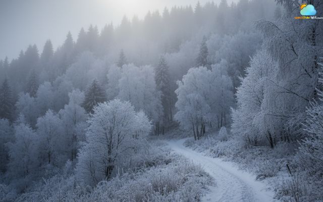
Freeze fog can create hazardous conditions
Freezing fog occurs most often in winter in regions prone to temperature inversions, where cold air is trapped near the ground.
If you want to learn more about its formation and how to stay unharmed in freeze fog, check out our detailed guide on What is freezing fog.
Conclusion
The types of fog vary widely, from valley fog to arctic ice fog, each with unique hazards. Recognizing their features and causes equips you to take precautions and navigate safely whenever fog reduces visibility.
Frequently Asked Questions (FAQs)
Related post

13 Interesting Fact about Fog: You Will Be Surprised At The Last One

What Is Fog? Understand Its Formation, Causes, and Impacts

0 Comment
Leave a comment
Your email address will not be published. Required fields are marked *