




Incoming El Nino Could Bring Major Weather Shifts In These Regions


Incoming El Nino has reached “very strong” status, according to NOAA data released September 14, with Pacific sea surface temperatures more than 2°C above average. The event could shift rainfall, heat, and storm patterns worldwide, affect US winter weather and food supplies, and influence hurricane activity. Here’s what to expect as El Nino strengthens through 2027.
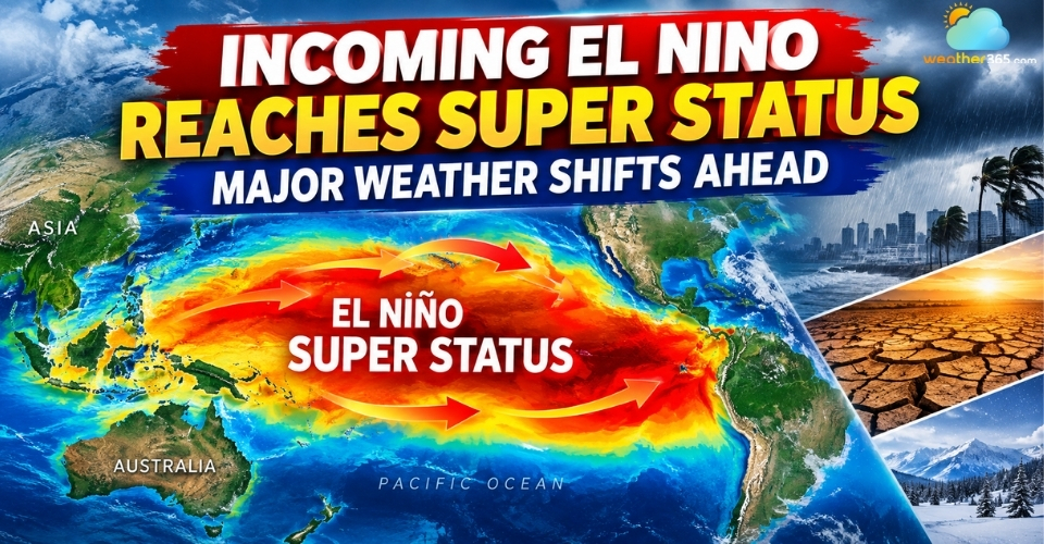
Incoming El Nino reaches super status
- Incoming El Nino reaches super status
- Where will incoming El Nino bring rain, drought and heat?
- Wetter conditions across some regions
- Drier and hotter conditions elsewhere
- What could El Nino mean for US winter weather?
- Could incoming El Nino affect hurricanes?
- What does incoming El Nino mean for food supplies?
Incoming El Nino reaches super status
Data released by the US National Oceanic and Atmospheric Administration (NOAA) on September 14, 2026, shows that ocean temperatures in the equatorial Pacific have risen more than 2°C (3.6°F) above average.
The reading puts the current El Nino in NOAA’s “very strong” category, while “super El Nino” is an informal term used for events at this intensity.
The 2026 El Nino began developing in June and has strengthened rapidly in recent months. NOAA now puts the chance of the event becoming the strongest El Nino on record at 75%.
Forecasters expect it to reach its peak in late 2026 or early 2027, with conditions potentially lasting through March-May 2027.
El Nino develops when unusually warm waters in the central and eastern Pacific alter large-scale atmospheric circulation.
These changes can shift weather patterns far from the Pacific, affecting rainfall, temperatures and storm activity across different parts of the world.
The strength of the event does not mean every region will experience stronger weather impacts, however, as local conditions and other climate patterns also play a role.
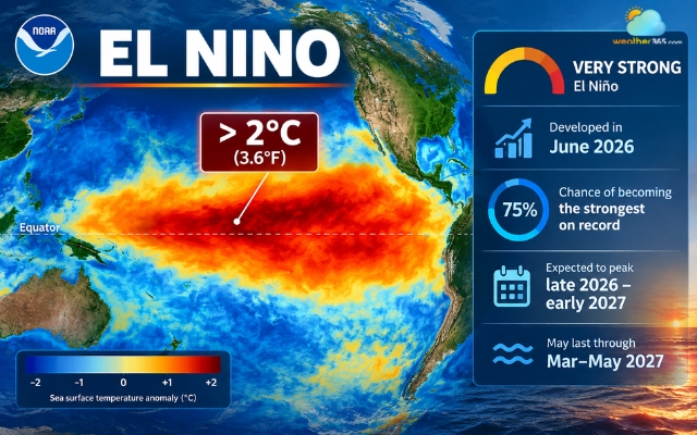
El Nino reaches “very strong status”
Where will incoming El Nino bring rain, drought and heat?
Forecasts point to wetter conditions in parts of East Africa, South America and the southern US, while South Asia, Southeast Asia, Australia and Southern Africa face a greater risk of drier conditions
Wetter conditions across some regions
East Africa is expected to see above-average rainfall between October and December.
Southern Ethiopia, central and southern Somalia and northeastern Kenya have a particularly high chance of wetter conditions.
Because this period provides a large share of the region’s annual rainfall, heavier precipitation could also increase flooding risks.
In South America, wetter conditions are expected along the coasts of Ecuador and northern Peru in early 2027.
Rainfall could later increase across southern Brazil, Uruguay and northeastern Argentina.
The southern US is also typically wetter during strong El Nino winters, although the exact pattern can vary between events.
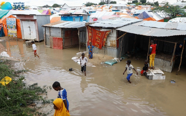
Rainfall across East Africa is expected to exceed seasonal averages (Photo: Feisal Omar/Reuters)
Check Houston’s latest hourly rain chances and precipitation totals to see when wetter conditions may arrive.
Drier and hotter conditions elsewhere
The pattern reverses across parts of South and Southeast Asia.
India has already recorded rainfall about 15% below average from June 1 to September 9, according to its meteorological agency.
Indonesia is also facing a drier season, with thousands of hotspots recorded by late July, raising concerns about wildfire conditions.
Australia is expected to see below-average rainfall across parts of the south and east, alongside warmer temperatures that could increase wildfire risk.
In Southern Africa, forecasts point to below-normal rainfall and above-normal temperatures through spring and summer.
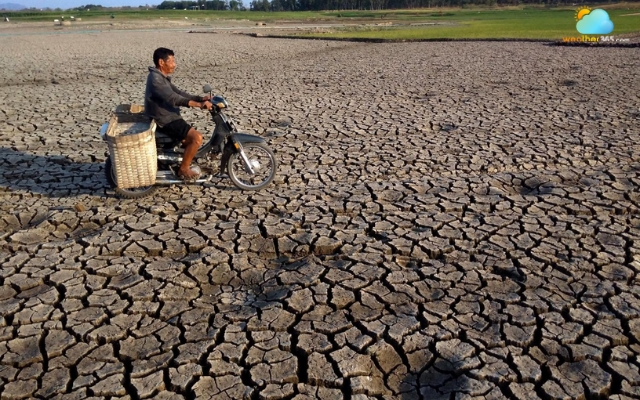
Indonesia is forecast to face a drier season (Photo: Ganug Nugroho Adi)
The warming signal can extend beyond these regional patterns.
The WMO expects above-normal temperatures across almost all regions during September-November, with El Nino typically having its strongest global temperature effect in the year after it develops.
Keep an eye on Sydney’s temperature and precipitation forecast for early signs of a shift toward warmer, less rainy conditions.
What could El Nino mean for US winter weather?
El Nino can significantly alter the US winter by shifting the position of the Pacific jet stream.
During El Nino winters, the jet tends to extend farther south and east, steering more storms across the southern part of the country.
This can create a wetter pattern across parts of the South while changing temperature and snowfall patterns farther north.
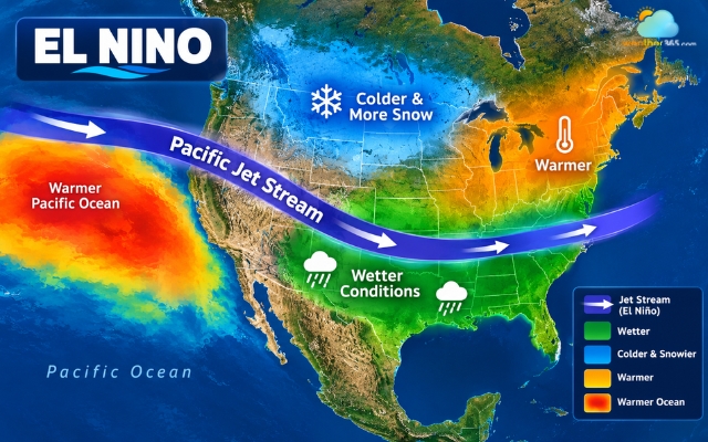
El Nino can shift the position of the Pacific jet stream
Past El Nino winters have been linked to below-average snowfall across areas including the Great Lakes, interior New England, the northern Rockies, the Pacific Northwest, western Canada and Alaska.
Meanwhile, the southern US, particularly higher elevations, has often seen more snow.
However, NOAA stresses that these are historical tendencies rather than a precise forecast for the 2026-27 winter. Individual El Nino events can produce different results.
See Chicago’s upcoming 7-day precipitation trends to stay ahead of changing winter conditions.
Could incoming El Nino affect hurricanes?
A strong El Nino can also change the environment for tropical cyclones.
In the Atlantic, it typically strengthens upper-level winds, creating greater vertical wind shear that can disrupt developing storms.
This is one reason NOAA gave a 75% chance of a below-normal Atlantic hurricane season in its August outlook.
Recent observations also show unusually low Atlantic activity, with meteorologists linking the quiet season partly to the strong El Nino.
The pattern can be different in the Pacific, where weaker wind shear can support tropical cyclone development. However, El Nino does not determine hurricane activity by itself.
(Read more: What is the difference between a hurricane typhoon and cyclone?)
Ocean temperatures, atmospheric moisture and conditions in other ocean basins can also influence how many storms form and how strong they become.
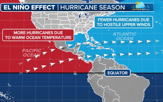
El Nino strengthens upper-level winds in the Atlantic ocean (Source: FOX Weather)
What does incoming El Nino mean for food supplies?
The effects of El Nino could extend beyond weather as drier conditions put pressure on agriculture in vulnerable regions.
The World Food Programme estimates that the event could push at least 49 million additional people into acute hunger by the end of 2027, raising the total across the 45 countries it assessed from 225 million to 274 million.
Eastern and Southern Africa and Latin America could see some of the largest increases.
Rain-fed crops such as maize and rice are particularly exposed because their yields depend heavily on seasonal rainfall.
Prolonged dryness could threaten harvests across Southern Africa, the Sahel, South Asia and Southeast Asia, where some communities already face food and water pressures.
The risk is therefore not simply lower rainfall, but the potential for disrupted harvests to add further pressure to food supplies and vulnerable households.
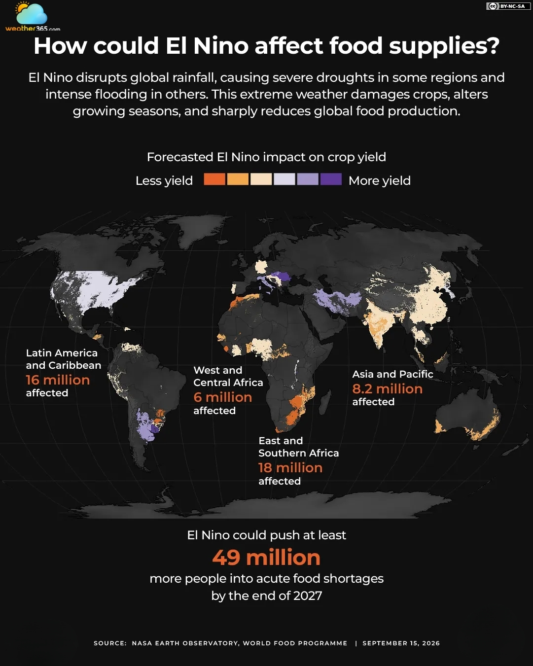
Impacts of El Nino on food supply (Source: Al Jazeera)
The incoming El Nino is expected to strengthen further before peaking in late 2026 or early 2027.
Forecasters will closely monitor Pacific temperatures and atmospheric patterns as the event unfolds.
With impacts likely persisting into spring 2027, global communities must prepare for a volatile period of extreme weather and economic strain.
References
1. Al Jazeera
2. The Guardian
3. CNN
Related post
Is a super El Nino coming in 2026? Here's what we could expect
 192
192
 0
0
 4.8
4.8
 16/04/2026
Return of El Nino Could Trigger Record Heat and Climate Extremes
163
0
4.6
02/06/2026
Super El Nino Builds as U.S. Faces a Wetter, Stormier Winter
91
0
5.0
12/08/2026

0 Comment
Leave a comment
Your email address will not be published. Required fields are marked *