




First Nor’easter of the Season: Timeline, Impacted Areas, and Forecast


The first nor'easter of the season is taking shape along the East Coast. The developing storm brings gusty winds, heavy rain, and dangerous coastal flooding to millions of residents. Weather experts warn that rough surf and beach erosion will persist for several days. Here's the latest look at the storm’s timeline and expected impacts.
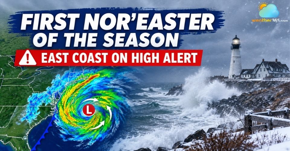
First Nor’easter of the season brews along the East Coast
KEY TAKEAWAY
|
First Nor’easter of the Season is Forming Across the East Coast
Fall has officially arrived, and it brings the first nor'easter of the season right to the Eastern Seaboard.
After a relatively quiet summer with minimal tropical activity, forecasters are now turning their focus to this brewing autumn storm.
See more: What is a Nor'easter?
The system forms as a broad area of low pressure off the Carolinas interacts with a strong high-pressure system sitting over eastern Canada.
This sharp atmospheric pressure gradient creates strong, persistent northeasterly onshore winds.
High pressure to the north will initially slow the storm down, trapping it over coastal waters for several days before allowing it to advance north.
Rather than passing quickly, this atmospheric setup will prolong hazardous coastal conditions.
Temperatures across the Mid-Atlantic and Northeast will drop into a crisp fall pattern, with highs lingering in the 50s and 60s.
However, the brisk winds and heavy surf will dominate the early days of autumn.
.jpg)
First Nor’easter of the season brews along the East Coast
Where and When the Storm Hits First?
The slow-moving nature of the system means different coastal regions will face peak impacts at different times throughout the week.
Early Week: The Outer Banks and Southeast Coast
Impacts begin early in the week for North Carolina’s Outer Banks and adjacent coastal areas.
Specifically, strong northeasterly winds reaching 40 to 50 mph will generate offshore waves up to 18 feet high.
Multiple high-tide cycles will cause major coastal flooding, severe beach erosion, and ocean overwash onto coastal highways like Route 12.
Check the real-time wind speeds for Nags Head before driving through low-lying roads.
Mid to Late Week: Mid-Atlantic to New Jersey
By Thursday and Friday, onshore winds will push water into back bays and tidal rivers from Virginia up to New Jersey.
Continuous wind action across successive tide cycles risks moderate to major tidal flooding.
Wind gusts of 30 to 40 mph are expected, with precipitation spreading inland depending on how close the low tracks to the shoreline.
The Weekend: Boston and New England
Heading into the weekend, the storm system moves toward Northern New England and Atlantic Canada.
Forecasters note that Boston remains a key focal point.
If the storm tracks close to the coast, Boston could experience wind gusts of 60 to 70 mph alongside heavy rainfall and localized storm surge.
Portions of Nova Scotia and southern New Brunswick could also see soaking rain and blustery conditions by late Friday.
.jpg)
Rain forecast from FOX Weather
Have a plan in Massachusetts? Track the rainfall totals for Boston to stay ahead of sudden storm impacts.
Coastal Flood and Beach Erosion Warnings Issued
Coastal flooding and rough seas pose the greatest threat to life and property during this prolonged event.
The continuous onshore flow traps water in bays and rivers, leading to compounding flooding during high tides.
.jpg)
Flooding on streets in Avalon caused by powerful Nor’easter in Oct. 2025 (Photo: Anadolu/Getty Images)
Coastal erosion will also undermine beaches and beachfront structures.
Authorities advise coastal residents to secure loose outdoor items and prepare for potential power outages caused by falling tree branches.
Stay safe with Power outage safety tips!
Avoid driving through flooded coastal roadways, as water levels can rise rapidly during tide cycles.
Mariners and beachgoers should stay off the water due to life-threatening surf and rip currents.
Keep checking the latest weather news and updates on Weather365 as minor shifts in the storm track can change severe rainfall boundaries.
References
FOX Weather
The Weather Network
North Jersey
Related post
What's the difference between a nor'easter and a hurricane? Full explained
 1433
1433
 8
8
 4.8
4.8
 01/04/2026

East Coast Flash Flooding: Prompt Alerts for Millions Across Major Metro Areas
556
0
4.6
13/09/2026
Where do most floods happen in the United States? High-risk areas
137
8
4.8
26/08/2026

0 Comment
Leave a comment
Your email address will not be published. Required fields are marked *