Strong tornadoes very large hail could hit Minnesota on Monday ( Updated)
Up to three possible tornado touchdowns, along with very large hail and heavy rain, affected several communities in Minnesota. The storms began shortly after 4 p.m. on Monday and persisted through the afternoon and evening as they moved across southern and southeastern Minnesota before reaching western Wisconsin. In addition to the suspected tornado activity, dozens of hail reports were recorded.

Strong tornadoes hit Minnesota
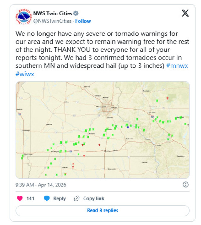
9.30 p.m: Reports 3 tornadoes
The National Weather Service reports three confirmed tornado occurrences during the first severe weather outbreak of the season on Monday afternoon and evening in southern Minnesota.
One tornado was reported west of Amboy, while another captured on video by FOX Weather struck the town of Truman.
At this time, there have been no major reports of damage or injuries linked to the storms.
By 9:45 p.m., officials indicated that all tornado warnings had been lifted, signaling the end of the immediate threat for the night.
The NWS announcement on X
8.15 p.m: Severe threat to southern Minnesota
The National Weather Service reports that storms are starting to consolidate, with the severe weather threat now confined to far southern Minnesota.
The main hazards remain damaging winds and large hail. Meanwhile, areas along and north of the line stretching from Saint James and Mankato to Red Wing and Eau Claire are largely clear, aside from a few isolated showers.
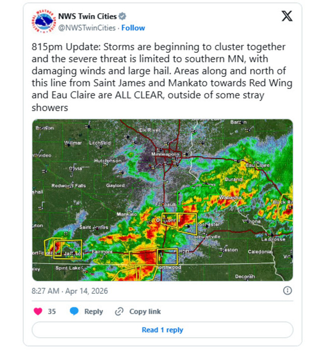
NWS announcement at 8.15 p.m
6.25 p.m: A confirmed tornado is west of Amboy
A confirmed tornado touched down at approximately 6:25 p.m. on Monday, west of Amboy, Minnesota, in southwestern Blue Earth County. It remained on the ground until about 6:46 p.m., during which time it caused damage to a farm outbuilding.
6:15 p.m: A tornado warning in Blue Earth
The National Weather Service issued a Tornado Warning for Blue Earth, Martin, and Watonwan counties through 6:45 p.m.
Shortly before 6 p.m., a severe thunderstorm with the potential to produce a tornado was detected about six miles northwest of Truman, or roughly 17 miles north of Fairmont, moving east at around 20 mph.
The storm was also capable of producing hail as large as tennis balls. Communities in its path included South Branch, Truman, and Lewisville.
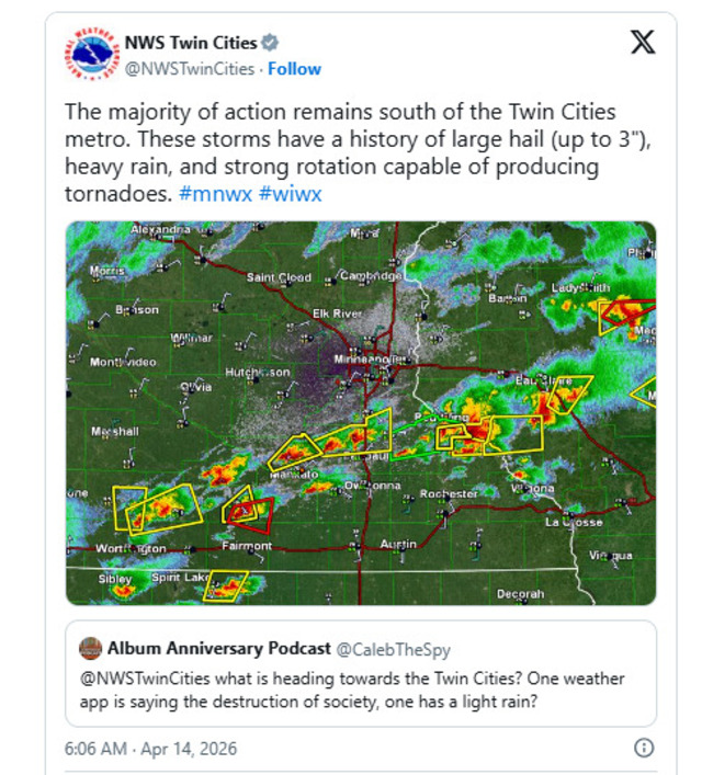
6 p.m: Severe thunderstorms across southern Minnesota
Southern Minnesota remained under the impact of severe thunderstorms Monday night, following earlier tornado warnings issued for Rice and Goodhue counties.
A line of strong storms formed, stretching from just north of Worthington through Mankato, Faribault, and Northfield, and continued moving east-northeast.
These storms have a history of producing hail up to 3 inches in diameter, along with heavy rain and rotation that could lead to tornado development. A Severe Thunderstorm Warning remained in effect for this line until 7 p.m.
NWS Twin Cities on X
5 p.m: Large hail in southern Minnesota
Severe storms moving across Minnesota on Monday brought notably large hail, as shown in multiple photos.
The National Weather Service reported hailstones up to 3 inches in diameter in Rice County, where a tornado warning had been issued.

Large hail in Minnesota
In other areas, hail sizes varied, with egg- and golf ball-sized stones reported in Faribault, while Cannon Falls saw hail closer to ping pong ball size.
In Faribault, officials also shared an image showing such an intense accumulation of hail that it was heavy enough to require plowing.
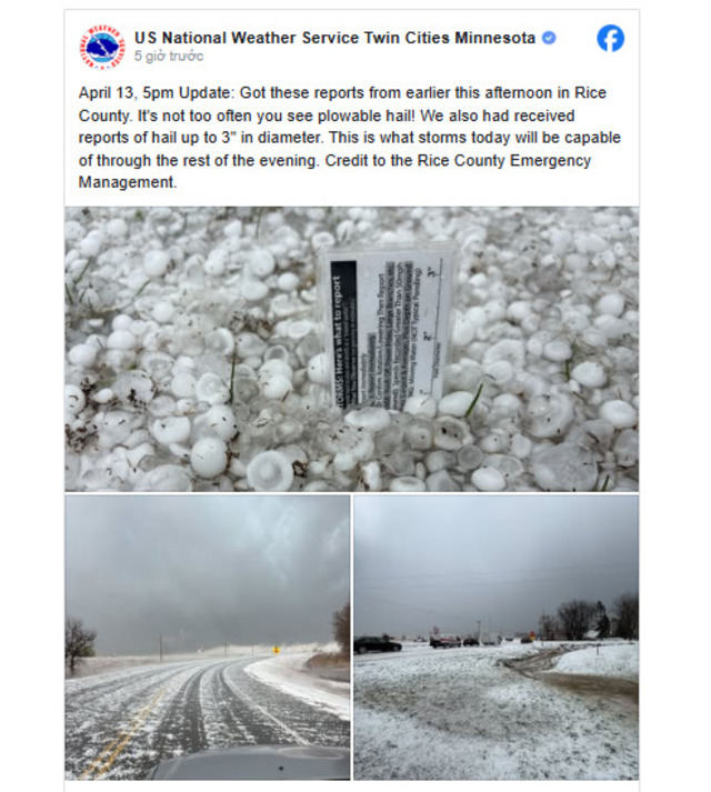
US National Weather Service announces plowable hail in Rice County
Stay tuned for the latest weather forecast with Weather365.com.
Related post

Exploring Types of Thunderstorms and Their Unpredictable Impacts

How To Survive a Thunderstorm: Essential Survival Tips for Your Safety

0 Comment
Leave a comment
Your email address will not be published. Required fields are marked *