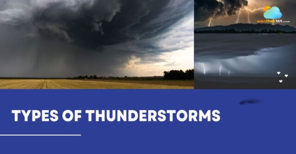
Exploring Types of Thunderstorms and Their Unpredictable Impacts
Uncover the secrets of the sky with our in-depth guide to the types of thunderstorms. While some fade in minutes, others unleash destructive winds and tornadoes. This guide explores their characteristics, environmental conditions, and special forms, helping you understand how thunderstorms develop, why they differ, and what impacts they can unleash.
How many types of thunderstorms are there?
Types of Thunderstorms: By Structure and Scale
Thunderstorms are usually categorized based on wind shear, atmospheric instability, lift, and available moisture.
In this section, we will look at the four main structural types: single-cell thunderstorms, multi-cell clusters, multi-cell lines, and supercells.
Now scrolling down to discover!
Ordinary/Single-cell Thunderstorm
Single-cell thunderstorms, often known as isolated thunderstorms, are the most prevalent and fundamental kind of thunderstorm.
They are also known as “pop-up” or “pulse” storms as they develop and dissipate quickly, typically lasting 30-60 minutes.
Single-cell thunderstorm
Main features of single-cell thunderstorm include:
Little wind shear
Wind speed and direction don't change much with altitude.
Usually isolated and don't produce widespread severe weather like tornadoes or large hail ( See also: How does hail form?) .
Three-stage life cycle: A single-cell thunderstorm progresses through three distinct stages: Cumulus, Mature, and Dissipating stages.
Multi-cell cluster
Multi-cell storms are more complex and organized than single-cell storms.
They consist of a cluster of individual storm cells in different stages of their life cycle, with new cells forming as old ones dissipate.
This type of thunderstorm often forms in environments with moderate to strong wind shear.
Multi-cell cluster
There are several notable characteristics of multi-cell thunderstorms as follows:
Wind shear enables the storm to maintain itself by separating the updraft from the downdraft.
Made up of multiple individual cells in different stages of development (new, mature, and dissipating), organized into a cluster.
Can result in more severe weather conditions, such as strong gusts, huge hail, flash flooding, and heavy rain.
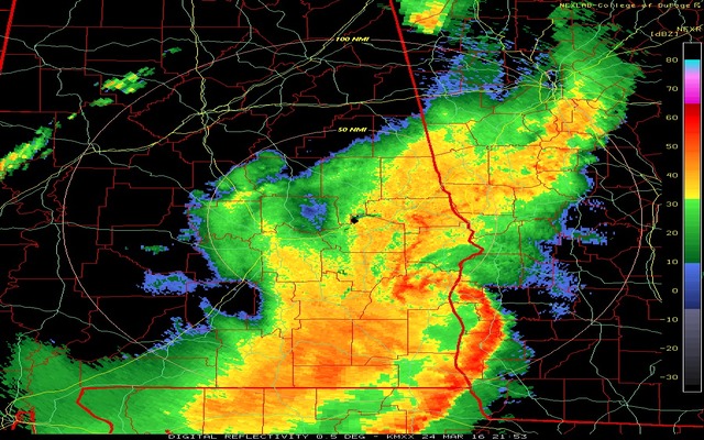
Multi-cell Line (Squall Line)
Often called a squall line, a multi-cell line is a long, narrow band of thunderstorms.
These lines can last for several hours and stretch for hundreds of miles. They function as a single, massive storm system and are extremely well-organized.
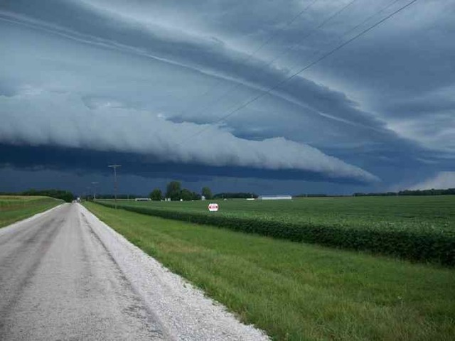
Multi-cell Line Thunderstorm
In particular, multi-cell lines are usually:
Arranging in a line, often along a cold front or other weather boundary.
Strong outflow of cool, rain-cooled air rushes ahead of the line, acting like a mini cold front.
Powerful, straight-line winds can be just as damaging as a tornado.
Torrential rain and large hail.
May develop a "bow echo" on radar, which is a bow-shaped segment of the line.
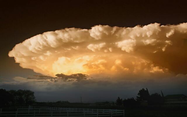
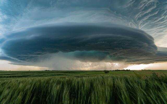
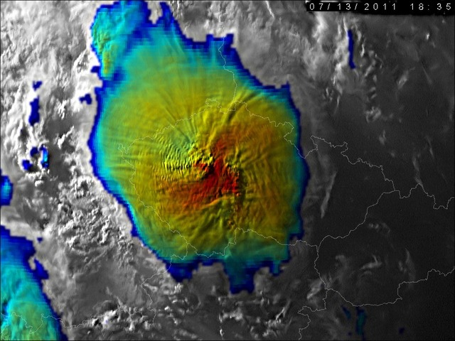
Supercell Thunderstorms
Among the four types of thunderstorms, supercells are the most dangerous and powerful ones.
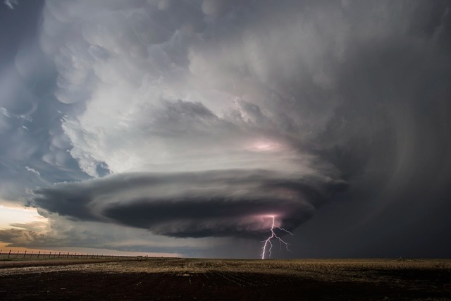
Supercell Thunderstorm
They are identified by a mesocyclone, which is a rotating updraft that can last for hours.
They form in environments with strong vertical wind shear, where winds change speed and direction with height.
Below are some features of Supercell thunderstorms:
One updraft that rotates and can continue for hours at a time.
The rotating updraft and downdraft are separated, allowing the storm to maintain its energy and organization.
Supercell thunderstorms produce nearly all the strongest and most violent tornadoes, as well as very large hail. For example, the 2011 Joplin, Missouri EF5 tornado (from a supercell) caused 158 fatalities and $2.8 billion in damage — one of the deadliest and costliest tornadoes in U.S. history.
Supercells can be classified into 3 different types based on precipitation. They are low-precipitation (LP), classic, and high-precipitation (HP) supercells.
For a detailed description of this thunderstorm type, you can drop by “What is a supercell thunderstorm?”
Here is a comparison table of 4 types of thunderstorms. Have a look!
Thunderstorm Type | Single-cell | Multi-cell Cluster | Multi-cell Line | Supercell |
Structure | One isolated updraft and downdraft | Group of storm cells in various life stages | Long, narrow line of storms | Single, rotating updraft (mesocyclone) |
Key Features | Small, short-lived, weak vertical wind shear | New cells form as old ones dissipate, and moderate wind shear | Organized along cold fronts, strong outflow boundaries | Highly organized, separated updraft/downdraft, strong vertical shear |
Duration | 30–60 minutes | 1–3 hours | Several hours, may extend hundreds of miles | Several hours |
Hazards | Localized heavy rain, small hail, brief gusty winds | Strong winds, large hail, flash floods, and tornadoes are possible | Damaging straight-line winds, heavy rain, hail, and occasional tornadoes | Strongest tornadoes, giant hail, severe winds, flash flooding |
Common Locations | Worldwide, especially on summer afternoons | Common in mid-latitudes with unstable air | U.S. Midwest, Great Plains, frontal zones | Great Plains (U.S. “Tornado Alley”), Australia, South America |
Thunderstorms by Environmental Conditions
While structure defines a storm’s size and organization, the surrounding environment also shapes its behavior.
Specifically, thunderstorms are often classified as either dry or wet, depending on how much rainfall they produce and where they typically occur.
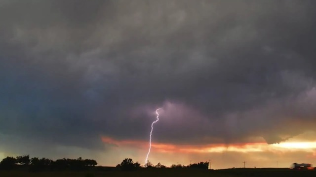
Dry
A dry thunderstorm is characterized by lightning and thunder without significant rainfall at the surface.
Dry Thunderstorm
This phenomenon usually occurs in arid or semi-arid regions, where the lower atmosphere is extremely dry.
Although the storm cloud in a dry thunderstorm may contain significant moisture, the falling precipitation evaporates before it can reach the surface..
Dry thunderstorms often:
Poses unique hazards such as wildfires due to lightning strikes.
Have lightning strikes occur without any accompanying rain at the surface.
Produce strong, damaging winds (dry microbursts) from the cooled, descending air.
The sky may look ominous, and you can hear thunder, but the ground remains dry.
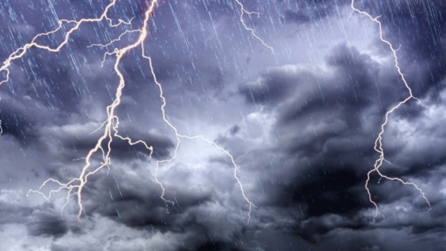
Wet
A wet thunderstorm is a thunderstorm where significant precipitation (rain, hail, or snow) reaches the ground. This is the more common type of thunderstorm we typically think of.
Wet Thunderstorm
Wet thunderstorms can arise when there is a lot of moisture present from the ground up to the storm cloud. The air below the cloud is humid enough that the falling precipitation does not evaporate before it reaches the surface.
Wet thunderstorms have several characteristics as follows:
Extremely heavy rainfall
Obscured Hazards such as the updraft and any tornadoes.
Flash flood threat
Severe weather potential, including tornadoes covered in rain, powerful gusts, and huge hail.
Special Thunderstorm Types
Beyond common classifications, some thunderstorms evolve into larger or more complex systems.
These include bow echoes, mesoscale convective systems, mesoscale complexes, vortices, and derechos, each with unique impacts and hazards.
Bow echo
A bow echo is a squall line's radar signature that "bows out" when winds drop behind it and circulations form on either end. Strong winds in the center of the storm line are indicated by this form.
Bow echoes are notorious for producing widespread straight-line wind damage, sometimes exceeding hurricane force.
These winds can seriously damage structures and perhaps bring down trees and electrical lines.
The United States is where bow echoes are most frequently seen, particularly in the Midwest and Great Plains, where powerful squall lines regularly form.
Bow Echo
Mesoscale Convective Systems (MCS)
Mesoscale Convective System (MCS) is an all-encompassing term for a collection of thunderstorms that act as a single, large system. An MCS can span an entire state and last for more than 12 hours.
On radar, it can appear as a solid line, a broken line, or a cluster of individual storm cells.
An MCS is a broad category of organized thunderstorm complexes that can take several forms. It commonly includes Mesoscale Convective Complexes (MCCs) and Mesoscale Convective Vortices (MCVs).
Mesoscale Convective Systems (MCS)
Mesoscale convective complex (MCC)
An MCC is a specific type of MCS that appears as a large, circular, and long-lasting cluster of storms when viewed by satellite.
MCCs often form during the late-night and early-morning hours and can cover a huge area.
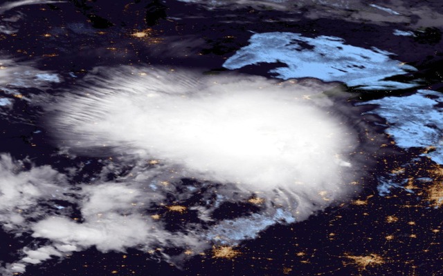
Mesoscale convective complex (MCC)
Mesoscale convective vortex (MCV)
An MCV is a low-pressure center that can form within an MCS.
With a core only 30 to 60 miles wide and 1 to 3 miles deep, an MCV is often overlooked in standard weather analyses.
But an MCV can take on a life of its own, persisting for up to 12 hours after its parent MCS has dissipated.
Mesoscale convective vortex (MCV)
Sometimes, an MCV can act as the nucleus for a new round of thunderstorms or even contribute to the formation of a tropical storm or hurricane.
Derecho
A derecho is a widespread, long-lived wind storm associated with a fast-moving band of showers or thunderstorms.
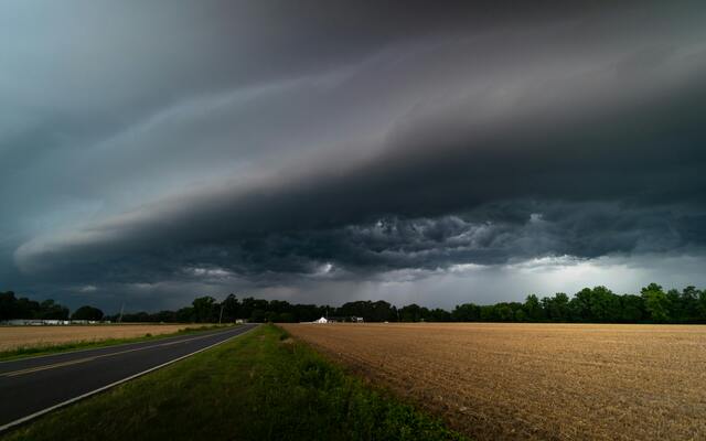
Derecho
The damage from a derecho is similar to that of a tornado but is characterized by straight-line winds.
For an event to be classified as a derecho, the wind damage must extend for more than 240 miles (about 400 km) with gusts of at least 58 mph (93 km/h) or greater.
Conclusion
From common single-cell storms to the destructive power of supercells and squall lines, each has unique characteristics. Understanding the different types of thunderstorms is key to staying safe. Keep an eye on local forecasts, recognize these signs, and always have a safety plan in place.
Frequently Asked Questions (FAQs)
Related post

What Is an Isolated Thunderstorm Compared to a Scattered One?

What Causes Thunderstorms? Explore the Science Behind Intense Events

What Is a Supercell Thunderstorm? Key Features and How It Forms

0 Comment
Leave a comment
Your email address will not be published. Required fields are marked *