What Is Derecho? Discover Definition, Causes, and Safety Tips
What is a derecho, and why does it matter? In this guide, you’ll discover how these powerful windstorms form, the main types, historic events, and most importantly - simple safety tips to keep you prepared when one strikes. Diving in! Learn the broader concept of windstorms...
What Is Derecho?
- What is Derecho?
- Features of Derecho
- Historical Examples of Derechos
- Differences Bow Echoes and Downbursts
- What Causes Derecho?
- A "bow echo" thunderstorm system
- A strong outflow boundary
- Types of Derecho
- Serial derecho
- Progressive derecho
- Hybrid derecho
- Can Derecho be predicted?
- How to Stay Safe During a Derecho?
- Before a Derecho
- During a Derecho
- After a Derecho
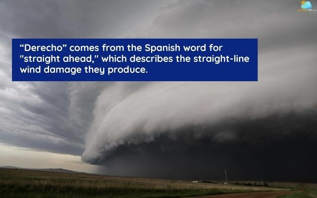
What is Derecho?
The term derecho - meaning “straight” in Spanish - was first coined in 1888 by University of Iowa physicist Gustavus Hinrichs to describe a type of straight-line What is a windstorm.
A derecho is a rare but extremely powerful windstorm that travels along a long path, producing straight-line winds capable of causing widespread damage.
What is a derecho storm?
Unlike tornadoes, which spin violently in a localized area, derechos push strong winds in one general direction, often over hundreds of miles.
These storms usually form during warm months, particularly from late spring through summer, and are most common in the central and eastern United States.
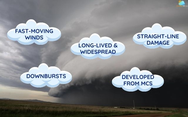
Features of Derecho
Derechos are defined not just by their strength but by a unique set of features that set them apart from ordinary thunderstorms:
Fast-moving winds: powerful winds, with gusts of at least 58 mph along a long path.
Straight-line damage: Unlike the rotating winds of a tornado, derecho winds are straight-line and blow in one general direction.
Widespread and long-lived: The storm system must have a continuous path of damage stretching for over 240 miles.
Derechos develop from large, fast-moving clusters of thunderstorms known as Mesoscale Convective Systems.
Downbursts: Strong winds are generated by intense downbursts - cold air that rapidly sinks to the ground and spreads out.
Features of Derecho
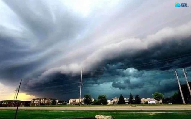
Historical Examples of Derechos
Throughout history, several derechos have left lasting marks with their scale and destruction.
Two of the most striking examples - the 2020 Midwest storm and the 2012 East Coast event - show the scale of destruction these rare windstorms.
August 2020 Midwest Derecho
The August 10, 2020, Midwest derecho is considered one of the most destructive derechos in the US’s history.
Wind speeds reached an astonishing 140 mph in parts of Iowa, equivalent to a Category 4 hurricane.
It began in eastern Nebraska and raced across Iowa, Illinois, Wisconsin, and Indiana.
The storm flattened millions of acres of corn and soybean fields during peak growing season, causing agricultural losses worth billions of dollars.
In addition to widespread crop damage, thousands of homes and businesses were damaged or destroyed, and nearly 1.9 million people lost power for days.
Derecho coming to Iowa August 10, 2020
June 2012 Derecho
The June 29, 2012, derecho is remembered for its rapid development and massive scale.
Originating in the Midwest, it swept through multiple states, including Ohio, West Virginia, Virginia, Maryland, and the District of Columbia, before reaching the Atlantic Coast.
With wind gusts exceeding 80 mph, the storm left over 4 million people without electricity during a record-breaking heat wave.
The storm felled countless trees, blocked major roads, and caused extensive property damage.
Tragically, dozens of fatalities were reported, many linked to heat-related illnesses following prolonged power outages.
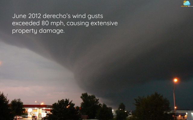
Derecho swept five states of the US in June 2012
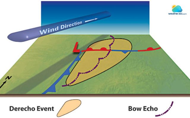
Differences Bow Echoes and Downbursts
Bow echoes and downbursts are both tied to severe thunderstorms, yet they describe very different storm behaviors.
Bow Echo
A bow echo is a distinctive radar signature that looks like a curved line of thunderstorms.
This arc shape indicates powerful winds pushing the storm system forward.
Bow echoes are often a signal that conditions are favorable for derechos, especially if the system remains organized and long-lasting.
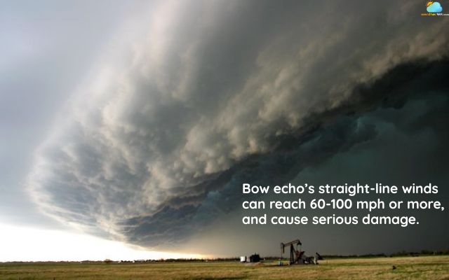
A bow echo swept through Great Bend on May 6, 2008
Downbursts
Downbursts happen when a mass of cold air plunges rapidly from a thunderstorm to the ground.
Once it hits the surface, the air spreads outward, creating intense straight-line winds.
A single downburst can cause local damage, but when multiple downbursts align within a bow echo, the setup may escalate into a derecho.
Feature | Bow Echo | Downbursts |
Definition | Radar signature shaped like a bow, showing an arc of thunderstorms. | A rapid column of cold air descending from a thunderstorm. |
Appearance | Seen as a curved line of storms on weather radar. | Felt as strong, sudden wind bursts at ground level. |
Scale of Impact | Large-scale, often stretching hundreds of miles. | Localized, usually a few miles wide. |
Role in Derechos | Indicates organized, advancing storms that can evolve into derechos. | Provide the intense straight-line winds that fuel and sustain derechos. |
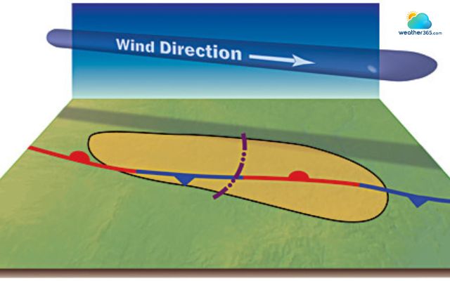
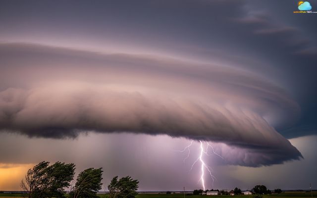
What Causes Derecho?
Derechos are caused by a specific set of atmospheric conditions that lead to the formation of a large, organized, and long-lasting complex of thunderstorms.
The key ingredient is the presence of strong downbursts.
A "bow echo" thunderstorm system
Derechos are produced by a specific type of storm system known as a mesoscale convective system (MCS)
This is a curved line of thunderstorms that looks like a bow on radar.
The "bow" shape is a key indicator of strong winds, as the most intense winds are typically found at the center of the bow.
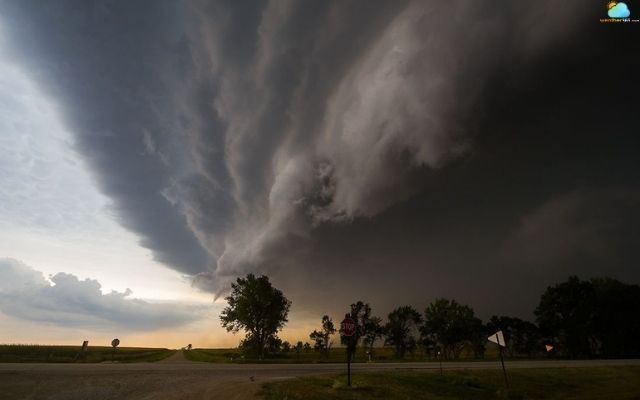
An intense bow echo in Watertown South Dakota in August 3, 2012
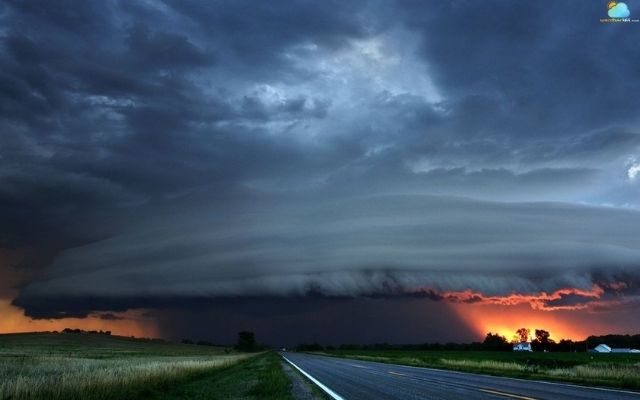
A strong outflow boundary
As the cold, dense air from the downbursts spreads out, it creates a powerful "outflow boundary" at the leading edge of the storm.
This boundary acts like a miniature cold front, lifting the warm, moist air ahead of it and fueling new thunderstorms.
The conditions needed for a derecho to form include:
High humidity: Ample moisture is needed to fuel the thunderstorms.
Instability: The atmosphere must be unstable, meaning that the warm, moist air near the surface is much less dense than the cooler air above it. This allows air to rise rapidly and form powerful updrafts.
Wind shear: There must be a change in wind speed and direction with height. This helps to organize the storms into a long-lived system and allows the cold downdrafts to be separated from the warm updrafts, preventing the storm from "choking itself out."
What causes a derecho storm?
When these conditions come together, a thunderstorm complex can develop.
The thunderstorm then produces a series of intense downbursts pushing the storm forward at high speeds, creating the widespread and destructive wind event that we call a derecho.
Types of Derecho
Meteorologists classify derechos into different types based on their structure and how they form.
The three main categories are serial derechos, progressive derechos, and hybrid derechos.
Serial derecho
A serial derecho usually develops within a large-scale weather system, often associated with a strong cold front.
These events cover vast areas, sometimes stretching across multiple states. The thunderstorm line is often very long, forming a massive bow-shaped arc that can extend hundreds of miles.
Key traits: Widespread damage, very strong winds, and long duration.
Typical season: More common in the cooler months (fall and spring), when large frontal systems dominate weather patterns.
Because of their size and intensity, serial derechos are often remembered as historic, high-impact storms.
For instance, the April 4, 2011 event that swept across the Southeast with winds topping 80 mph, leaving a trail of destruction from Arkansas to Georgia.
Serial derecho
Source: National Oceanic and Atmostpheric Administration
Progressive derecho
A progressive derecho is smaller in scale compared to a serial one but can be just as fierce. It forms when a cluster of thunderstorms rapidly organizes into a bow echo and accelerates forward.
Progressive derecho
Source: National Oceanic and Atmostpheric Administration
Key traits: Narrower damage path but extremely intense winds.
Typical season: Most frequent in summer, when hot and humid conditions provide abundant energy for thunderstorms.
These derechos often move so quickly that communities have little time to prepare.
Despite affecting smaller regions, they can still cause severe damage to trees, power lines, and buildings.
This can be seen in the notorious June 29, 2012 outbreak that raced from the Midwest to the Mid-Atlantic, leaving millions without power.
Hybrid derecho
A hybrid derecho shares features of both serial and progressive types.
It may cover a wide area like a serial derecho but develop in an environment that resembles that of a progressive one.
Key traits: Mixed characteristics, with damage that can be both widespread and locally intense.
Typical season: Can occur in different seasons depending on the overlapping weather patterns.
Hybrid derecho
Hybrids are harder to classify because they don’t fit neatly into one category. Still, they highlight how derechos can evolve in complex ways depending on the atmosphere.
Much like the August 10, 2020 Midwest derecho, which produced hurricane-force winds above 100 mph, flattened crops across Iowa, and caused billions of dollars in losses.
Can Derecho be predicted?
Predicting a derecho is one of the toughest challenges for meteorologists. Unlike hurricanes, which can be tracked days in advance, derechos form from fast-changing thunderstorm systems that evolve within hours.
Forecasting them requires a close watch on atmospheric ingredients and the ability to detect when storms might organize into a long-lived bow echo.
Meteorologists rely heavily on computer models, satellite data, and radar to monitor the conditions that can give rise to a derecho.
Warm, humid air at the surface, combined with strong winds in the upper atmosphere, often sets the stage. When these elements align, storms can quickly develop into a dangerous system.
However, pinpointing the exact timing and path is difficult because small shifts in temperature, moisture, or wind can change the storm’s behavior.
Can Derecho be predicted?
Typically, the Storm Prediction Center (SPC) and local weather agencies issue severe thunderstorm watches and warnings when the atmosphere shows signs of producing derechos.
These alerts may highlight the risk of damaging winds across a wide region.
Still, people often only realize a derecho is underway once radar shows a powerful bow echo racing across the landscape.
Derechos can be anticipated in terms of risk zones, but forecasting their exact track and intensity remains limited.
This is why weather agencies emphasize preparedness and quick response to severe thunderstorm warnings.
How to Stay Safe During a Derecho?
High winds from a derecho can turn a normal day upside down in minutes. Knowing what to do at each stage of the storm makes it easier to protect yourself and your loved ones.
Before a Derecho
Preparation is the strongest shield against a derecho. Taking early steps can reduce risks and protect both people and property.
Monitor weather forecasts and severe thunderstorm watches.
Prepare an emergency kit with water, food, flashlights, and first-aid supplies.
Fully charge phones and backup batteries.
Secure or bring indoors loose outdoor items like furniture or tools.
Identify a safe shelter inside your home, such as a basement or windowless room.

What to prepare before a derecho?
During a Derecho
When the derecho comes, every second counts. Staying calm and knowing where to shelter can make a life-saving difference.
Move indoors immediately and stay away from windows.
If driving, pull over safely and seek shelter in a sturdy building. More How to drive in high winds
Do not hide under overpasses or bridges, as winds intensify there.
If trapped in a car, stay buckled, keep your head low, and cover yourself if possible.
Follow local alerts through a weather radio or mobile device.

Seeking shelter if you are outside during a derecho
After a Derecho
The storm may pass quickly, but hazards often linger. Taking careful steps afterward helps ensure safety and recovery.
Watch out for downed power lines, fallen trees, and unstable debris.
Avoid flooded roads or damaged areas until cleared by officials.
Operate generators outdoors only, never inside.
Check on neighbors and share supplies if needed.
Document property damage with photos for insurance claims.
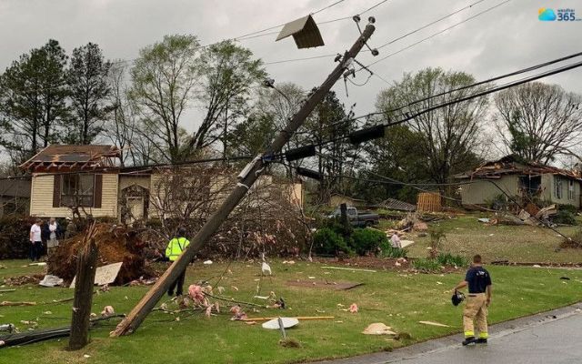
After the derecho hit in Alabama
For broader wind event safety checklist: High winds safety tips
Conclusion
Derechos do not happen every day, but when they do, the damage is unforgettable. The more we know about what is derecho, how they form and how to stay safe, the better chance we have to face them with confidence.
Frequently Asked Questions (FAQs)
Related post

How To Drive In High Winds? Dangers and Practical Steps to Stay Safe

Vital High Winds Safety Tips: What to Do Before, During, and After

0 Comment
Leave a comment
Your email address will not be published. Required fields are marked *