Storm watch in California: 100 mph gusts, up to 48 inches of snow
Spring may be on the calendar, but the atmosphere didn’t get the memo. While a storm watch in California signals trouble out West, parts of the Northeast and Midwest are dealing with their own abrupt reversal, like the weather hit rewind without warning.
Just days after warm air and open windows, a biting chill has pushed back in. Temperatures that recently climbed into the upper 80s have dropped below freezing, with the National Weather Service issuing freeze warnings as if this were just another routine swing.
It’s not extreme, but it feels out of place—an edge of cold that catches you off guard. The kind that makes you question the season and wonder if that stretch of warmth was just a brief illusion.
Storm watch in California
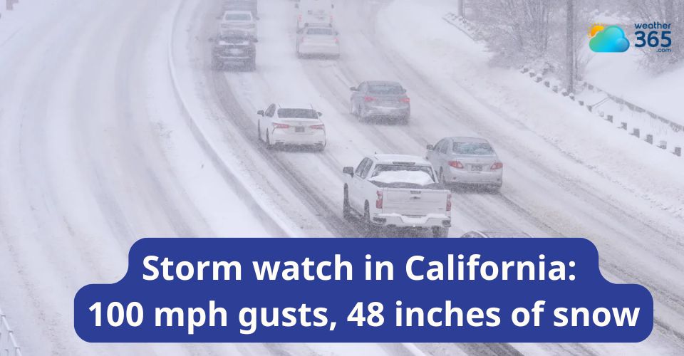
A storm watch in California is now in effect as forecasters warn of a powerful system targeting the Sierra Nevada, with heavy snow and strong winds also extending into parts of Nevada.
The National Weather Service says an incoming upper-level low and Pacific фронт will steadily increase precipitation along the West Coast over the next few days.
Light showers may begin across Northern California before conditions intensify, bringing broader areas of moderate to heavy rain by Monday.
By Tuesday, the system is expected to expand its reach into the Pacific Northwest, Southern California, and sections of the Great Basin, raising concerns about isolated flooding along coastal ranges and in the Sierra foothills.
Higher elevations in the Sierra are forecast to receive significant snowfall, with totals ranging from a foot to as much as two feet at the highest peaks.
In the Greater Lake Tahoe region, several inches of snow are likely above mid-elevations, with lighter accumulations possible near the lake level.
Gusty winds could reach 30–35 mph in lower areas, while exposed ridgelines may see extreme gusts approaching 90 mph.
Farther west, communities across the northern and central Sierra are also bracing for heavy snow, with widespread totals between 12 and 18 inches and locally higher amounts in elevated terrain.
Snow levels could drop low enough to bring minor accumulations to lower elevations, while southwest winds may gust up to 50 mph.
The storm system is expected to remain active through early Tuesday, creating hazardous travel conditions and rapidly changing weather across the region.
What to do if seeing a winter storm:
Seeing a winter storm approaching isn’t the moment to “wait and see”—conditions can deteriorate faster than most people expect. Whether you’re at home, on the road, or outdoors, a few smart decisions can make a big difference.
If you’re at home, stay inside and limit travel. Keep essentials within reach: water, non-perishable food, flashlights, extra batteries, and a charged phone. Power outages are common in winter storms, so having blankets and warm clothing ready matters. If you use heaters or fireplaces, make sure they’re properly ventilated to avoid carbon monoxide buildup.
If you’re driving, reconsider. Roads can turn dangerous quickly due to snow, ice, or low visibility. If you must go out, drive slowly, keep a safe distance, and carry an emergency kit with items like a blanket, snacks, water, jumper cables, and a phone charger. If you get stranded, stay with your vehicle—it provides shelter and is easier for rescuers to find.
If you’re outside, seek shelter immediately. Strong winds and freezing temperatures can lead to frostbite or hypothermia in a short time. Cover exposed skin, wear layers, and avoid overexertion, which can increase heat loss.
Stay informed by following updates from the National Weather Service and local authorities. Alerts like winter storm warnings or advisories are issued for a reason—they’re your cue to take conditions seriously.
Related post

Severe Weather Including Tornadoes Expected In Midwest South And Plains

Frost advisory in the Piedmont for Tuesday, temperatures as low as 33

0 Comment
Leave a comment
Your email address will not be published. Required fields are marked *