




Michigan flood watch: Evacuations underway as river flooding, dam failure


Flood alerts are active on both shores of Lake Michigan as several rivers rise to, or near, flood stage, placing parts of the region under a heightened Michigan flood watch.
In Green Bay, Wisconsin, authorities are warning residents along the East River to be ready for possible evacuation.
Successive rounds of thunderstorms bringing heavy rainfall have caused river levels across the Midwest to surge, increasing the risk of flooding.
Consequently, the National Weather Service office in Green Bay has issued flood warnings for portions of east-central and northeastern Wisconsin, including the city of Green Bay, after widespread road closures were reported following Monday night’s storms.
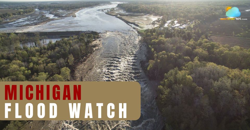
NWS has issued flood warnings in Wisconsin
According to NOAA monitoring data, at least five rivers in Wisconsin have reached, or are expected to reach, major flood stage. In addition, a flash flood warning has been issued due to concerns over a potential failure of the Big Falls Dam along the Little River in Waupaca County. Emergency officials warn that any breach could trigger life-threatening flash flooding downstream along the Little Wolf River.
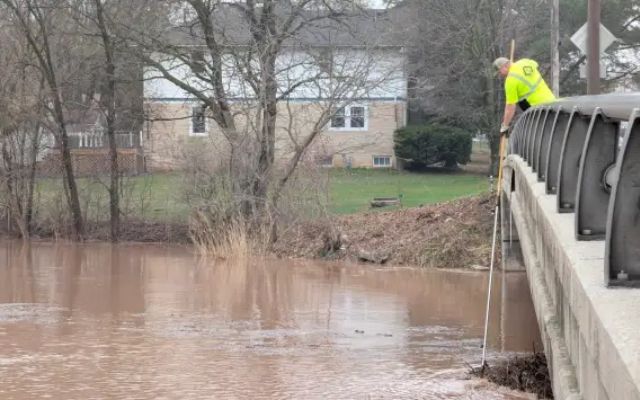
A Green Bay city crew is monitoring conditions along the East River
Local authorities in Weyauwega confirmed that evacuations have already begun in vulnerable downstream areas. Residents living along Guth Road, Kurth Drive, Deer Haven Road, Ona Pines Road, and County Road F near Gills Landing have been urged to leave immediately and bring essential belongings, including identification, medications, pets, and communication devices.
An emergency shelter has been opened at the community center inside Weyauwega City Hall on Main Street to accommodate displaced residents.
Across Lake Michigan, flood risks are also intensifying. Forecasts indicate that at least four river gauges in Michigan could surpass historical records this week, while eight or more are expected to reach major flood levels, reinforcing concerns under the ongoing Michigan flood watch.
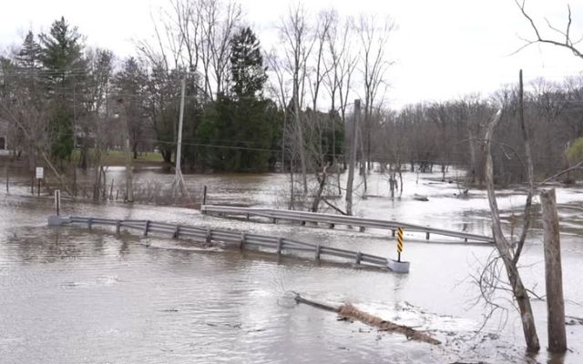
Flood warnings are still in effect across Mid-Michigan
Meteorologists warn that conditions are unlikely to improve in the short term. Additional rainfall is expected Tuesday night, which could further elevate river levels and worsen flooding impacts. Although a brief lull in precipitation may occur on Wednesday, more showers and thunderstorms are forecast to return Wednesday night into Thursday, prolonging the flood threat.
The pattern of repeated rainfall is expected to aggravate flooding before conditions gradually stabilize. Another round of rain is likely late Friday into Saturday, potentially extending the period of high water. A more sustained stretch of drier weather may not arrive until late weekend or early next week, offering some relief to affected areas.
Related post
Winter Storm: Basic Understanding about Snowstorm, Blizzards, & More
 1478
 6
 4.6
 01/04/2026
How To Survive a Thunderstorm: Essential Survival Tips for Your Safety
1223
8
4.7
15/09/2026

Northern California spring storm: Heavy rain, Thunderstorm, Sierra snow
171
8
4.8
10/04/2026

8 Comment
Ryker Patterson
Does a flood watch mean people should evacuate immediately?
weather365
Not necessarily. A watch means flooding is possible, so people should monitor updates and be ready to act if a warning or evacuation order is issued.
Eli Berry
Why are low-lying areas usually at higher risk during a flood watch?
weather365
Water naturally collects in low areas, and poor drainage can make flooding worse when rainfall exceeds the ground or drainage system’s ability to handle it.
Jude Green
Can a flood watch be issued even when flooding hasn’t started yet?
weather365
Yes. A watch is issued when the risk has increased but the timing or location of flooding is still uncertain, giving people time to prepare.
Margaret Rogers
What exactly does a flood watch mean compared with a flood warning?
weather365
A flood watch means conditions are favorable for flooding, but flooding is not necessarily happening yet. A warning means flooding is occurring or is considered imminent.
Leave a comment
Your email address will not be published. Required fields are marked *