What Is a Supercell Thunderstorm? Key Features and How It Forms
What is a supercell thunderstorm, and why is it considered the most dangerous type of storm on Earth? This article will help you answer that question by explaining how supercells form, their defining features, the main types, and the extreme weather they can produce, from giant hail to violent winds and deadly tornadoes.
What Is a Supercell Thunderstorm?
- What is a supercell thunderstorm?
- Key characteristics
- How they differ from regular thunderstorms
- Types of supercell thunderstorms
- Classic Supercell
- High-Precipitation
- Low-Precipitation
- How Do Supercell Thunderstorms Form?
- Moisture at the Surface
- Instability in the Atmosphere
- Wind Shear
- A Trigger to Lift the Air
- Where Do Supercell Thunderstorms Mostly Happen?
- Tornado Alley (Great Plains, USA)
- Midwest & Southeastern U.S.
- Global Supercell Hotspots
What is a supercell thunderstorm?
A supercell thunderstorm is a highly organized, powerful storm system that stands apart from regular thunderstorms due to its distinct features and extreme weather-producing potential.
Supercells are among the most dangerous types of thunderstorms because they can spawn severe weather, such as massive hail, intense winds, and destructive tornadoes.
What are Supercell Thunderstorms?
Key characteristics
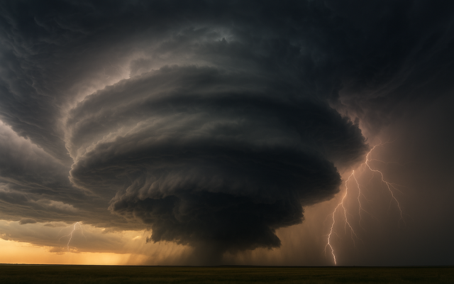
Supercells are defined by their intense, structured nature, setting them apart from other storm types.
They exhibit a range of distinctive characteristics that contribute to their strength and longevity.
Characteristics of a supercell thunderstorm
Here are the main features that define a supercell:
Hold a rotating column of air at the core, enabling the supercell to maintain strength and potentially form tornadoes.
Wind direction and speed variations with altitude produce rotation, which aids in the formation of the mesocyclone.
Last for hours, unlike regular thunderstorms that dissipate quickly due to their stable and organized structure.
It can cause extreme weather, such as large hail, violent winds, flash floods, and tornadoes.
Supercells are identifiable on Doppler radar by a “hook echo,” indicating a rotating updraft.
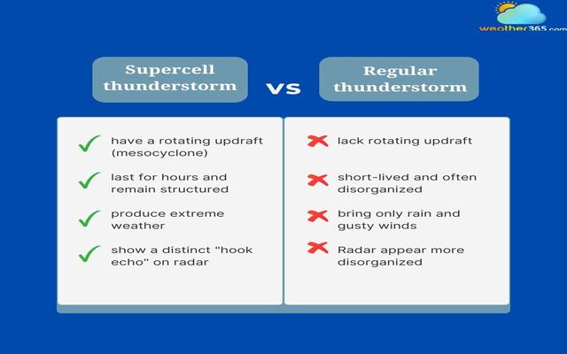
How they differ from regular thunderstorms
The main difference between supercells and regular thunderstorms is rooted in their structure, longevity, and ability to produce severe weather.
Let’s look deeper to distinguish these two types of thunderstorms!
Rotating updraft: The key feature of a supercell is a rotating updraft, which allows the storm to organize and strengthen. Regular thunderstorms lack this rotation and remain weaker.
Duration and structure: Supercells can last for hours while maintaining a strong, organized structure. Regular thunderstorms are usually short-lived and often fall apart quickly.
Weather severity: Supercells are capable of producing extreme weather, including giant hail, violent winds, and tornadoes. Regular thunderstorms, by contrast, typically bring only rain and occasional gusty winds.
Radar appearance: On radar, supercells show a distinctive “hook echo,” often a sign of possible tornado formation. Regular thunderstorms, however, appear disorganized and lack this signature.
Difference between supercell thunderstorms and regular thunderstorms
Types of supercell thunderstorms
Based on structure and precipitation characteristics, supercell thunderstorms are classified into three main types: Classic, High-Precipitation (HP), and Low-Precipitation (LP).
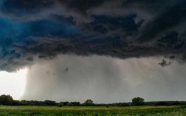
Classic Supercell
The Classic Supercell is the most commonly recognized type of supercell. It represents the "ideal" supercell structure, with a balanced mix of precipitation, rotation, and organization.
This type is particularly notable for its well-defined structure, which includes:
The storm may stay steady for longer as the updraft, or rising air, and the downdraft, or falling air, are widely separated.
Produce moderate amounts of rain and hail, with a visible structure that includes a towering cumulonimbus cloud.
Producing strong tornadoes, as the mesocyclone is often well-developed and organized, allowing tornado formation.
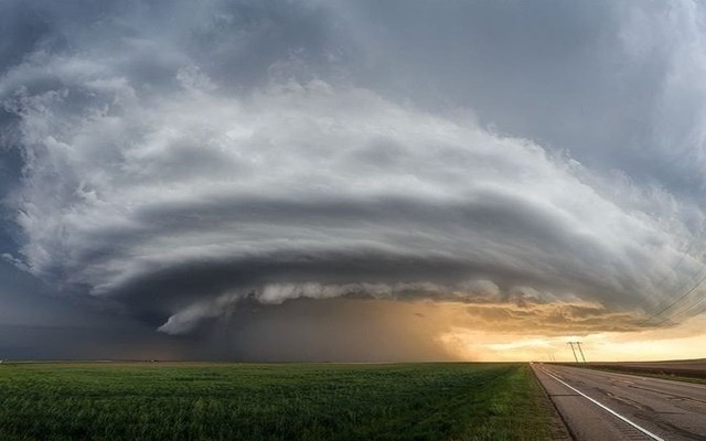
Classic Supercell
Classic supercells are most commonly associated with severe weather outbreaks, particularly in areas like Tornado Alley in the U.S.
They are ideal for storm chasers due to their predictable structure and high potential for large tornadoes.
High-Precipitation
As the name suggests, High-Precipitation (HP) Supercells are characterized by the high amount of rain and other forms of precipitation they produce.
High-Precipitation Supercell Thunderstorm
These storms can be more difficult to observe and track, especially for storm chasers, because of the dense rain surrounding the core of the storm. Key features of HP supercells include:
Produce large quantities of rain, often accompanied by smaller but still damaging hail. The heavy precipitation can obscure visibility and make it hard to spot tornadoes or other dangerous features.
Tornadoes in HP supercells are often "rain-wrapped," meaning they are difficult to see until they are very close.
Heavy precipitation often hides the storm’s rotation and updraft, making it harder for meteorologists to track the storm’s development in real-time.
HP supercells are more common in the eastern U.S., where moisture levels are higher, and they tend to produce more flash flooding and damaging winds alongside their tornado risk.
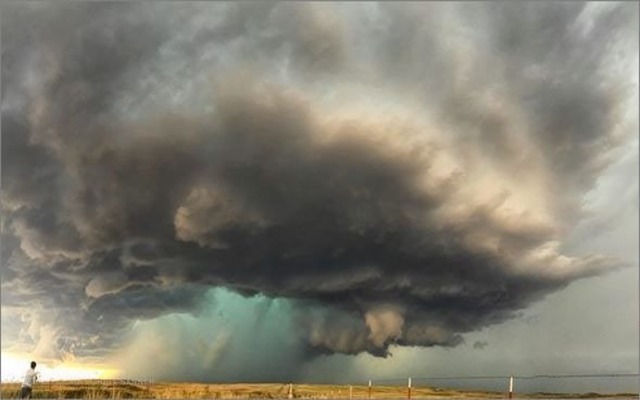
Low-Precipitation
In contrast to HP supercells, Low-Precipitation (LP) Supercells produce minimal rain and hail, which makes them more visually striking and easier to observe.
Low-Precipitation Supercell Thunderstorm
These supercells are particularly known for their dramatic cloud formations and more isolated nature. Here are some defining features of LP supercells:
Produce very little rain, sometimes only light showers or no precipitation at all. As a result, they are typically much easier to observe than HP supercells.
Capable of producing violent tornadoes and large hail.
Often have a very "photogenic" appearance, with sharply defined anvil clouds and rotating updrafts.
LP supercells are prevalent in the western United States and are usually observed in regions with drier air.
They are often part of larger storm systems that can spawn isolated tornadoes and intense wind events.
How Do Supercell Thunderstorms Form?
Supercell thunderstorms do not just appear out of nowhere.
So, what causes thunderstorms?
They require a very specific set of atmospheric conditions to develop and sustain their powerful structure.
How do Supercell Thunderstorms Form?
While many thunderstorms form when warm, moist air rises into cooler air above, supercells demand more dynamic interactions between moisture, instability, wind shear, and a trigger mechanism to kickstart the process.
Moisture at the Surface
The first requirement for any thunderstorm, especially a supercell, is ample moisture near the ground.
This moisture typically comes from large bodies of water like the Gulf of Mexico, supplying warm, humid air that rises into the atmosphere.
Without enough surface moisture, clouds can not grow tall or strong enough to become supercells.
High moisture level
Instability in the Atmosphere
The term instability describes the atmosphere's propensity to promote air rise. It occurs when warm, moist air near the surface is trapped beneath cooler, drier air aloft.
Since the warm air is lighter than the air above it, it rises swiftly when it is lifted by anything like a front or terrain.
Warm and moist air
This vertical motion is critical for thunderstorm development. Meteorologists measure instability using CAPE (Convective Available Potential Energy).
The higher the CAPE, the stronger the potential updrafts, and the more intense the thunderstorm.
Wind Shear
Wind shear is the secret ingredient that makes supercells unique. It involves changes in wind speed and direction with height, which create a rolling motion in the atmosphere.
For example, winds at the surface may blow from the south, while winds higher up may blow from the west.
When strong updrafts from rising warm air interact with this horizontal rotation, the motion is tilted vertically, forming a mesocyclone - the spinning heart of the supercell.
Without sufficient wind shear, thunderstorms may still form, but they will not have the rotation or structure to become supercells.
Wind shear contributes to the supercell’s formation
A Trigger to Lift the Air
Even if there is moisture, instability, and wind shear, the atmosphere still needs a trigger to get things moving. Common triggers include:
Cold fronts: Boundaries between cold and warm air masses
Drylines: Dividing lines between moist and dry air
Terrain: Hills or mountains that force air to rise
This lifting action initiates the upward motion needed to form towering thunderclouds, setting the stage for supercell development.
Once all the ingredients are in place, a supercell thunderstorm can begin to take shape.
The formation typically progresses through several stages:
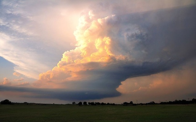
Cumulus stage: Warm, moist air rises, forming towering cumulus clouds as the updraft begins to strengthen.
Mature stage: A rotating updraft (mesocyclone) develops. Rain, hail, and lightning occur as the storm organizes.
Organized structure: Tilted updrafts keep precipitation away from the storm’s core, allowing it to persist for hours.
Severe weather production: The storm produces large hail, damaging winds, flash floods, and possibly tornadoes.
Where Do Supercell Thunderstorms Mostly Happen?
Supercell thunderstorms are most commonly found in regions where moisture, instability, and wind shear come together under the right conditions.
Where Supercell Thunderstorms Form?
Tornado Alley (Great Plains, USA)
When most people think of supercell thunderstorms, they immediately picture Tornado Alley.
This region includes Texas, Oklahoma, Kansas, and Nebraska, where weather systems collide dramatically: Warm, humid air streams northward from the Gulf of Mexico, dry desert air sweeps in from the southwest, and cooler air moves down from Canada.
When these different air masses meet, they create extreme instability. Add strong wind shear, and consequently, this place becomes one of the most active breeding grounds for supercells in the world.
Tornado Alley is especially dangerous in late spring and early summer, when the clash of seasons fuels storms that can rapidly spin into violent tornadoes.
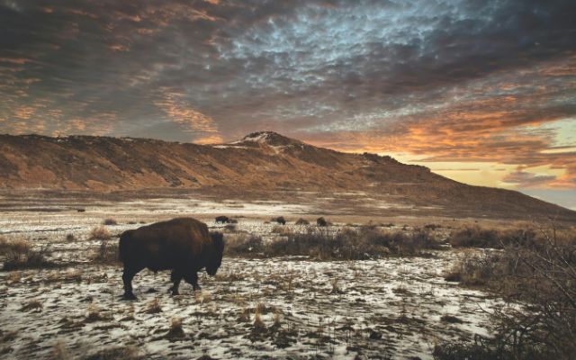
Great Plains, USA
Midwest & Southeastern U.S.
While Tornado Alley gets most of the attention, the Midwest and Southeastern states are also highly prone to supercells.
Places like Missouri, Arkansas, Alabama, and Mississippi often experience severe outbreaks in spring and early summer.
Unlike the open plains, these regions combine moisture-rich air with frequent frontal systems that sweep across the country. This setup can trigger long-lasting supercells that bring tornadoes, large hail, and dangerous flash flooding.
The Southeast is especially vulnerable because warm Gulf air is present almost year-round, making it easier for storms to develop even outside the peak tornado season.
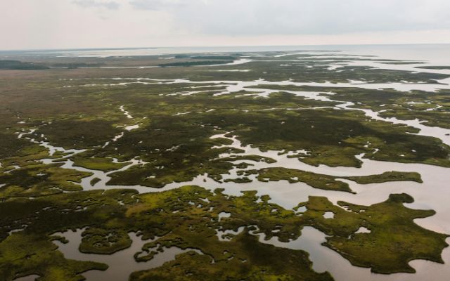
Moss Point, MS, United States
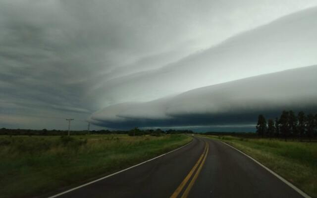
Global Supercell Hotspots
Supercell thunderstorms aren’t just an American phenomenon; they appear worldwide wherever the right conditions exist.
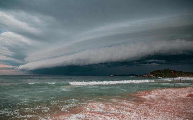
South America (Pampas Region): Argentina, Uruguay, and southern Brazil host some of the most violent supercells on Earth. The Pampas plain is known for producing giant hailstones
Eastern India & Bangladesh: Before the summer monsoon, this region experiences powerful storms called Nor’westers. With extreme heat and abundant moisture, they often intensify into rotating supercells, bringing damaging winds, hail, and lightning.
Australia (New South Wales & Queensland): During the warmer months, eastern Australia sees frequent supercells capable of unleashing huge hail and intense winds.
These global hotspots prove that while the U.S. is most famous for supercells, the phenomenon is not confined to North America. Anywhere with the right mix of heat, moisture, and wind shear can become the stage for these powerful storms.
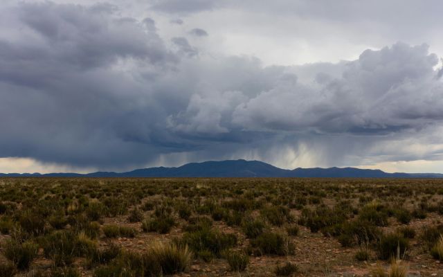
Supercell thunderstorm in Yavi, Jujuy, Argentina
Final Thought
In summary, understanding what is a supercell thunderstorm helps us recognize why these rare systems are among the most powerful and dangerous on Earth. By learning how they form, where they occur, and what sets them apart, we can improve preparedness and rely on early warnings to stay safe when they strike.
Frequently Asked Questions (FAQs)
◉ Visually: Look for a sculpted or corkscrew-shaped storm with a rotating wall cloud, a lowered, spinning cloud base.
◉ On radar: Doppler radar will show a distinct hook echo signature, where precipitation wraps around the rotating updraft.
Related post

What Is an Isolated Thunderstorm Compared to a Scattered One?

What Causes Thunderstorms? Explore the Science Behind Intense Events

0 Comment
Leave a comment
Your email address will not be published. Required fields are marked *