🌧️ 30-Day Rainfall Outlook & Local Rain Pattern
In the next 30 days, Kansas is projected to experience 17 rainy days, with an average daily rain chance of 19%.
Why Rain in Kansas is Different?
Rain here is rarely a calm, day-long drizzle. Kansas's unique location on the open plains creates distinct rain patterns:
1. Most Heavy Rain Happens Night & Early Morning
In many places, it rains on hot afternoons. But in Kansas, major rainstorms often build up over the Rocky Mountains during the day and sweep across Kansas overnight. Don't be surprised if you wake up to heavy downpours and loud thunder.
2. Heavy Bursts Over Quick Drops
Instead of steady rain all day, Kansas gets short, intense rainstorms. A single storm can dump 1 to 2 inches of water in less than an hour, which can cause quick street flooding before drying up just as fast.
3. Rain Often Brings Hail and Strong Winds
Because rainstorms in Kansas are powered by cold and warm air clashing together, heavy rain almost always comes with strong wind gusts (over 40 mph) and sometimes hail (falling ice balls).
4. East Kansas gets Much More Rain than the West
Rain is not spread evenly:
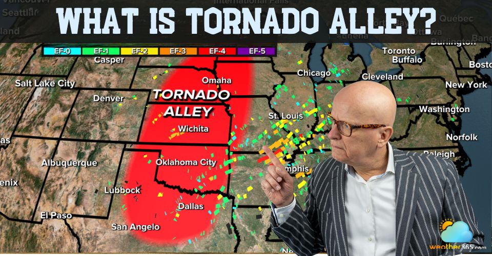
- Eastern Kansas (Wichita, Topeka, Overland Park) is greener and gets twice as much rain.
- Western Kansas (Dodge City, Goodland) is much drier, getting mostly quick, scattered rain showers.
💡 Simple Safety Tips for Kansas Rain
Slow Down on Highways (I-70 & I-35): Heavy rain creates puddles quickly on high-speed roads. Drive 10–15 mph slower to prevent your car from sliding (hydroplaning).
Park Under Cover: Because Kansas rainstorms often bring hail, park your car in a garage or under a carport when heavy rain is expected.
Turn Around, Don't Drown: Never drive through flooded roads or deep puddles on flat country roads. It is impossible to judge water depth safely from inside your car.
Note: Long-range rain forecasts show general monthly patterns. Re-checking short-term forecasts closer to your planned dates is recommended for exact timing.