




Super Typhoon Champi Officially Claimed as the Strongest Storm of 2026


The strongest storm of 2026, Super Typhoon Champi, has reached peak winds of 296 km/h, making it one of the most powerful tropical systems on record this year. The storm is moving across the western Pacific, with Taiwan and eastern China among the areas to watch as its forecast track develops. Here’s what to know.
Champi becomes the strongest storm of 2026
Quick Takeaways
Super Typhoon Champi reached peak sustained winds of 296 km/h, becoming the strongest storm of 2026 by wind speed.
Sea temperatures near 30°C and low wind shear helped Champi intensify over the western Pacific.
Champi moved westward after passing south of Guam, with Taiwan and Japan’s southwestern islands among the areas to monitor.
Forecasts projected Champi could weaken to Category 4 or Category 3 later in the week.
Super Typhoon Champi Becomes Strongest Storm of 2026
As of October 20, 2026, Super Typhoon Champi had become the strongest storm on Earth this year by maximum sustained wind speed.
Forecasters reported winds of 296 km/h and a central pressure of 895 millibars, placing Champi at the equivalent of Category 5 intensity on the Saffir-Simpson scale used for Atlantic hurricanes.
Champi’s rapid strengthening was supported by warm ocean waters, with sea surface temperatures near 30°C, abundant moisture and relatively low wind shear.
These conditions helped the storm maintain a well-organized structure as it crossed the western Pacific.
Champi surpassed Hurricane Polo’s peak sustained winds of 285 km/h.
However, Polo recorded a lower central pressure of 892 millibars, showing why storm rankings can differ depending on the measurement used.
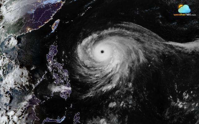
Typhoon Champi on satellite imagery on Oct.20, 2026 (CIRA)
Super Typhoon Champi’s Forecast Track and Timeline
After passing south of Guam over the weekend, Champi moved west across the western Pacific.
Its eye passed about 10 miles south of Guam, avoiding a direct landfall. Local officials reported minimal damage on the island despite the storm’s powerful winds.
Meteorologists projected that Champi would continue west toward Taipei before turning northwest later in the week.
Northern Taiwan, Okinawa and the Ryukyu Islands were also identified as areas to watch. However, the storm’s exact track and potential land impacts remained subject to change.
Champi was forecast to weaken to Category 4 or Category 3 intensity by Thursday or Friday as it moved into a less favorable environment.
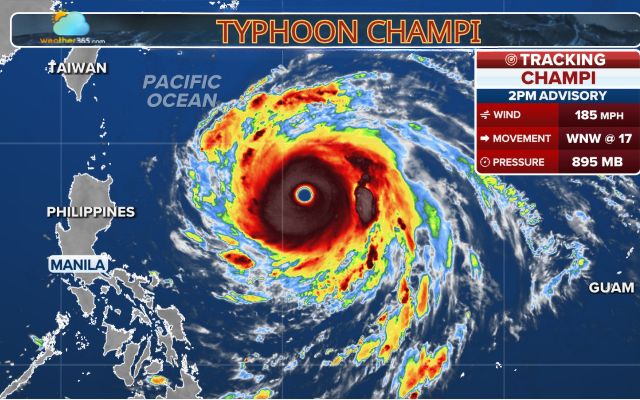
Champi is forecast to affect Northern Taiwan (Photo: FOX Weather)
Latest weather coverage
Potential Impacts of Super Typhoon Champi Across East Asia
Even if Champi weakens, it could still pose risks to areas near its projected path.
Strong winds, intense rainfall and thunderstorms may threaten exposed coastal locations, disrupt marine transport and create hazardous travel conditions.
Heavy rain can also increase the risk of localized flooding, depending on where the storm passes.
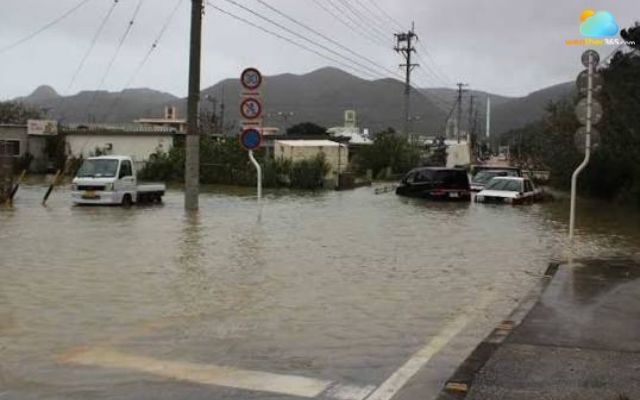
Residents in Okinawa should stay alert for flooding
Okinawa and the Ryukyu Islands remain important areas to monitor because of their position in the western Pacific.
The available reports identify these areas as potential threats, not confirmed locations for landfall.
People in Okinawa should follow local meteorological authorities for official warnings, evacuation guidance and updates on dangerous conditions.
Forecasters will continue tracking Champi as it moves toward East Asia. Its future impacts will depend on the storm’s changing intensity, direction and distance from land.
Stay ahead of severe weather with the latest alerts and forecasts on Weather365!
References
Fox Weather
Times Now
The Weather Network
Related post


Hurricane Trudy Moves Away From Mexico as Flood Threat Persists
 48
 0
 4.8
 19/10/2026

October Nor'easter Triggers Severe Mid-Atlantic Coastal Flooding
33
0
4.7
20/10/2026

0 Comment
Leave a comment
Your email address will not be published. Required fields are marked *