




Atmospheric Rivers Pacific Northwest to Bring Heavy Rain and Strong Winds


A series of atmospheric rivers is set to bring days of heavy rain and strong winds to the Pacific Northwest this week. The atmospheric rivers Pacific Northwest setup could increase flood risks across Washington and Oregon, while British Columbia faces heavy mountain snow. Here’s what to know.
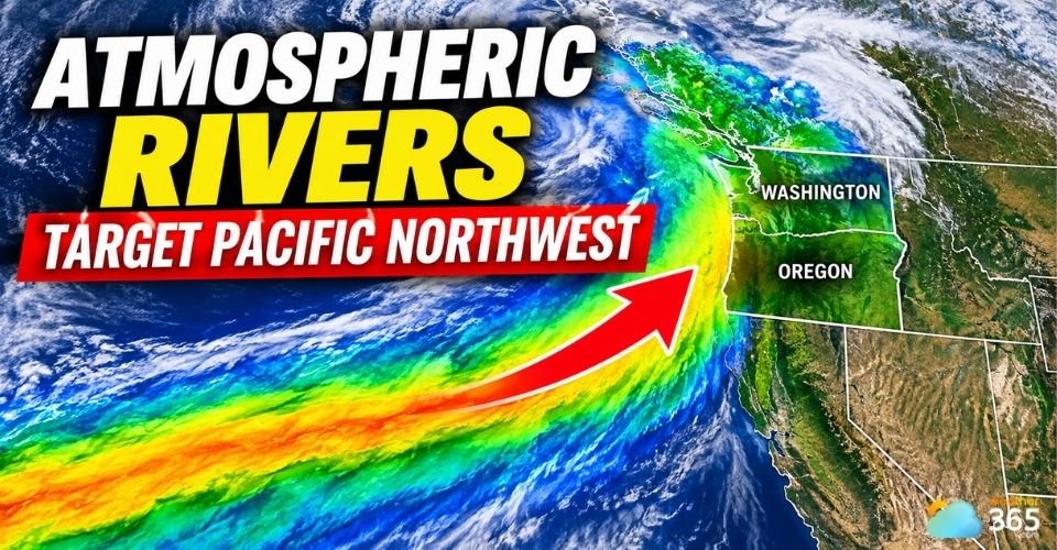
Atmospheric rivers Pacific Northwest
Atmospheric Rivers Pacific Northwest: Key Takeaways
Heavy Rain & Flooding: Severe moisture plumes will target the Pacific Northwest and British Columbia with 3–12+ inches of rain through November 14.
Wind Threat: Coastal and valley areas face gusty winds reaching up to 45–60 mph, increasing power outage risks.
Mountain Hazards: High-elevation snow (up to 10–20 feet in BC Coast Mountains) brings significant avalanche concerns.
Atmospheric Rivers Bring Heavy Rain to the Pacific Northwest
Several rounds of atmospheric rivers are expected to affect the Pacific Northwest from November 9 through the middle of the month, bringing repeated periods of rain and mountain snow.
The systems are forming as areas of low pressure move south from near Alaska toward southwestern Canada and northwestern Washington.
The Olympic Peninsula and northern Washington could receive 3–6 inches of rain through Monday.
The Portland metropolitan area is forecast to receive up to 1 inch, with much of the moisture staying farther north.
However, the unsettled pattern is expected to continue beyond the initial rainfall.
Forecasters say that some coastal areas of British Columbia and western Washington could receive more than 1 foot of rain through November 14.
The heaviest totals are expected on west- and south-facing mountain slopes.
Another stronger storm could reach Vancouver Island on Wednesday, November 11, before spreading rain across British Columbia, Washington, western Oregon and parts of Northern California later in the week.
Location | What to Expect |
Rain returns Monday afternoon, with wind gusts of 20–30 mph | |
Olympic Peninsula, WA | 3–7 inches of rain possible during upcoming atmospheric river events |
Washington Coast | Wind gusts could reach 35–45 mph Tuesday |
A brief midweek break before another round of rain late in the week | |
Oregon Cascades | Additional precipitation, with snow possible at higher elevations |
Flooding, Strong Winds and Heavy Mountain Snow Risk
Repeated rainfall could increase runoff as soils become saturated, raising the risk of flooding in small streams and rivers.
Forecasters also warn of possible mudslides and debris flows, especially around areas affected by recent wildfires.
The flood threat could become more serious during the second half of the week.
Southwestern British Columbia and Vancouver Island face a higher risk, while areas from southwestern Washington to Northern California could also experience significant flooding.
However, the exact location and severity of these impacts remain uncertain.
Strong winds are another concern. Several storms could bring gusty conditions along the coast and through mountain passes, potentially causing power outages and dangerous travel conditions.
Previous wind gusts across parts of Washington reached 50–60 mph at lower elevations, with higher elevations recording stronger gusts.
Meanwhile, heavy mountain snow is expected to affect British Columbia.
Some parts of the Coast Mountains could receive 10–20 feet of snow through November 14. Snowfall rates may exceed 6 inches per hour in the hardest-hit mountain areas.
Farther south, snow in Washington's Cascade and Olympic Mountains is expected to remain mostly limited to higher elevations.
Rapid changes between rain and snow could increase runoff and make mountain slopes less stable, raising avalanche concerns.
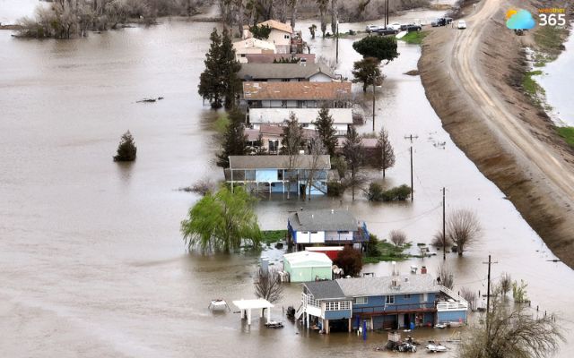
Flooding and landslide risks across parts of the Northwest (Photo: Fred Greaves/Reuters)
The atmospheric river pattern is expected to bring several more rounds of precipitation through the middle of November, although short breaks between systems are possible.
A brief period of calmer weather is forecast around midweek before another stronger system approaches.
Forecast models also suggest that additional moisture could spread farther south into Northern California toward the end of the week.
With rainfall accumulating across multiple systems, residents should monitor local weather alerts, river conditions, and road closures.
The timing and location of the heaviest precipitation may still change as the storms approach.
Stay updated on the latest severe weather news on Weather365 Trending News.
References
FOX Weather
Accuweather
Weather Nation TV
Related post
Auckland Thunderstorm Watch Issued As Heavy Rain And Severe Weather Sweep South
 82
 0
 4.7
 06/11/2026

Flash Flood Emergency Tennessee: Rescues Underway Along Georgia Border
30
0
4.7
06/11/2026
Early-Season Northeast Snow Storm Triggers Major Weather Shifts
26
0
4.8
09/11/2026

0 Comment
Leave a comment
Your email address will not be published. Required fields are marked *