



Auckland Thunderstorm Watch Issued As Heavy Rain And Severe Weather Sweep South


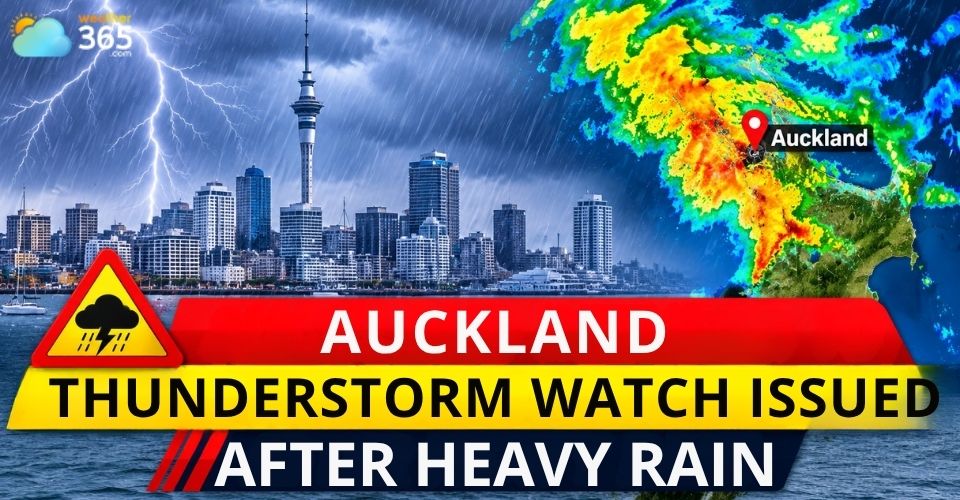
Auckland thunderstorm watch issued as powerful storms move south from Northland, bringing heavy rain, lightning and possible flash flooding. MetService has warned residents across several areas to prepare for intense downpours and hazardous travel conditions as unstable weather continues across the region.
Auckland thunderstorm watch
Auckland Thunderstorm Watch Issued as Storms Move South
MetService issued a severe thunderstorm warning for Kaipara and parts of Auckland at around 3 p.m. on Friday, November 6, after weather radar detected powerful storms moving southeast.
The warning covered Auckland City, Waitākere, Franklin, Rodney, the Gulf and Albany.
The renewed threat followed a band of heavy rain that swept across Northland earlier in the day.
What Is a Severe Thunderstorm Warning? A severe thunderstorm warning is issued when dangerous thunderstorms are detected by weather radar or reported by trained observers. It signals an immediate threat to life and property from hazards such as damaging winds, large hail and heavy rainfall. What to do:
Source: National Weather Service – Severe Thunderstorm Resources. |
By around 2 p.m., the rain band had moved south, bringing intense rainfall to areas around Doubtless Bay, inland from the Bay of Islands and Kaipara Harbour.
Some communities experienced particularly heavy downpours.
Northland Regional Council data showed that Pawarenga, in North Hokianga, recorded 30 mm of rain in one hour up to 1 p.m.
Heavy rainfall was also reported around Hakaru, near Kaiwaka, and the Pouto Peninsula.
The storms brought torrential rain, thunder and lightning as they approached Auckland. Residents faced another period of unsettled weather after the earlier rainfall across the northern region.
Check local rainfall, precipitation and wind conditions in Kaipara to monitor changing weather conditions before travelling.
Torrential Rain Raises Flash Flooding and Travel Concerns
The main concern is the intensity of rainfall expected from the thunderstorms.
MetService warned that severe storms could produce localized downpours of 25–40 mm per hour.
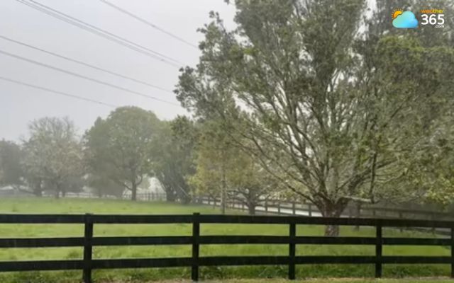
Torrential downpours in Auckland (Photo: MetService)
Such heavy rainfall can quickly overwhelm drainage systems and cause flooding, particularly in low-lying areas.
Streams, gullies, narrow valleys and urban streets are among the locations most at risk.
Rapid runoff may also increase the chance of slips, especially where the ground becomes saturated after prolonged rain.
Road users could face difficult conditions as heavy downpours reduce visibility and leave water across roads.
Motorists are advised to slow down, allow extra travel time and avoid driving through flooded sections. Even shallow floodwater can make roads dangerous.
The storm activity also brings lightning risks and the possibility of local power disruptions.
To stay safe, learn Flood Safety Tips!
Auckland Weather Warning Timeline and Safety Advice
MetService has issued several weather alerts as unstable conditions continue across the upper North Island.
The severe thunderstorm warning issued for Kaipara and parts of Auckland on Friday afternoon was followed by a wider severe thunderstorm watch.
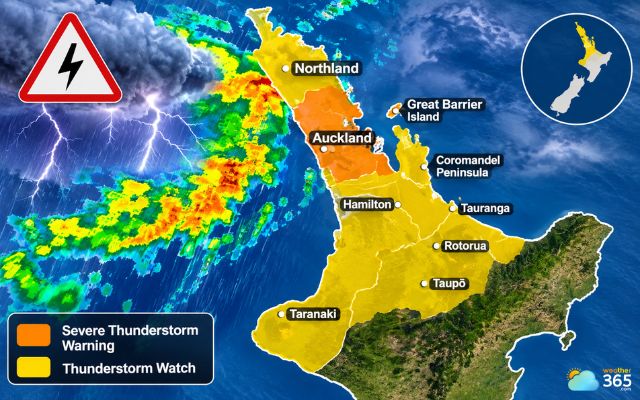
Severe thunderstorm warning issued for parts of Auckland
The warning and watch periods cover different stages of the developing weather threat:
Friday afternoon, November 6: A severe thunderstorm warning was issued for Kaipara and parts of Auckland after radar detected storms moving southeast.
Friday, noon to 9 p.m.: A severe thunderstorm watch remained in place for Northland and Auckland, indicating a continued risk of storms becoming severe.
Saturday, midnight to 11 a.m., November 7: Another watch covered a wider area, including Northland, Auckland, Great Barrier Island, Coromandel Peninsula, Waikato, Waitomo, Taumarunui, Bay of Plenty, Rotorua, Taupō and Taranaki.
The warning and watch periods cover different stages of the developing weather threat:
Under the Saturday watch, severe thunderstorms could again produce localized rainfall rates of 25–40 mm per hour, increasing the risk of flash flooding and slips.
Residents should continue monitoring official MetService updates because thunderstorm warnings can change quickly as weather systems develop.
References
Pacific Media Network
NewstalkZB
RNZ
Related post
Polar Vortex Split Forecast Signals an Unusual Winter 2026–2027
 508
 0
 4.7
 05/11/2026
Flash Flood Emergency Tennessee: Rescues Underway Along Georgia Border
19
0
4.7
06/11/2026

0 Comment
Leave a comment
Your email address will not be published. Required fields are marked *