




Latest El Niño Update: What to Expect in Winter 2026–2027


The latest El Niño update shows that the Pacific warming pattern is approaching its peak, with very strong conditions expected to continue through the winter. The phenomenon could bring significant changes to U.S. weather in 2026–2027, affecting temperatures, snowfall, and rainfall across several regions.
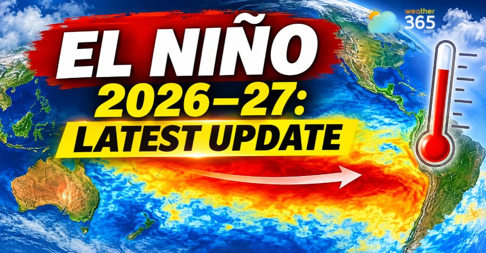
Latest El Niño update
Quick Takeaways: What to Expect in the US
U.S. Region | Expected Weather Patterns | Potential Impacts |
Northeast | Warmer-than-average conditions in some areas | Potentially reduced snowfall |
Southeast | Wetter conditions and increased storm activity | Heavy rainfall and localized flooding |
California | Increased precipitation in some areas | Heavy rain, mountain snow and flood risks |
Great Lakes | Variable temperatures and snowfall | Changing snow and winter storm patterns |
Latest El Niño Update: The Pacific Pattern Continues to Strengthen
El Niño continues to strengthen across the tropical Pacific, according to the National Oceanic and Atmospheric Administration (NOAA) Climate Prediction Center (CPC) update issued November 12, 2026.
The Niño-3.4 index, which measures sea surface temperature anomalies in the central and eastern equatorial Pacific, reached +2.5°C above average in October, up from +2.1°C in September.
Other areas of the eastern Pacific also warmed significantly, with the Niño-3 index reaching +3.6°C.
However, NOAA has lowered its estimate for the event to reach historic strength.
The probability of the Relative Oceanic Niño Index (RONI) reaching +2.5°C or higher fell from 83% to around 60% for October–December 2026.
The estimate for November–January also dropped from 70% to approximately 60%.
This change does not mean El Niño is weakening.
Instead, it reflects greater uncertainty about how extreme the event will become.
NOAA still expects a strong-to-very-strong event, with more than a 79% chance of those conditions continuing through January–March 2027.
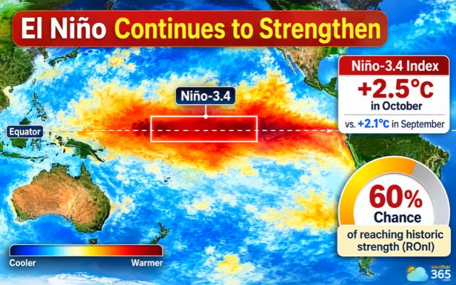
El Niño shows 60% chance of reaching historic strength alongside an October Niño-3.4 Index climb to +2.5°C.
When Will El Niño Peak and How Long Could It Last?
El Niño is now at or approaching its peak, according to experimental predictions released by NOAA's Geophysical Fluid Dynamics Laboratory (GFDL) on November 16.
The latest forecast suggests that the event may gradually weaken after reaching its strongest point.
However, its influence is expected to remain through the winter of 2026–2027.
NOAA's November outlook indicates that El Niño conditions could persist into early spring before transitioning toward ENSO-neutral conditions in late spring or summer 2027.
The probability of ENSO-neutral conditions returning during April–June 2027 is around 61%, compared with a 38% chance that El Niño will continue.
These estimates show that a transition is becoming more likely, although the timing remains uncertain.
Forecasters will continue monitoring Pacific Ocean temperatures and atmospheric conditions as the event evolves.
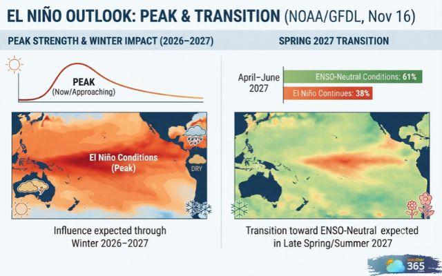
El Nino is currently peaking and will gradually weaken
How Could a Very Strong El Niño Affect U.S. Winter Weather?
A very strong El Niño could reshape winter weather patterns across the United States by influencing the jet stream, which helps steer storms and distribute cold and warm air.
(Read more: What is a jet stream)
NOAA's October seasonal outlook favors above-average temperatures across much of the northern and eastern United States.
The agency also expects wetter-than-normal conditions along parts of the East Coast. These patterns could influence snowfall, rainfall and storm activity during the coming months.
Northeast: Connecticut could see a relatively mild winter with below-average snowfall across much of the state.
Meteorologist Dan Amarante's seasonal outlook estimates 20–30 inches of snow near Bridgeport and 35–50 inches around Hartford and Bradley Airport.
Higher totals of 70–75 inches are possible near Norfolk in the northwest hills. However, individual winter storms could still bring significant snowfall.
Check the latest weather conditions and forecast in Connecticut to monitor local temperatures, precipitation, and upcoming winter systems.
Southern and Eastern United States: A more active southern storm track could bring periods of heavy rain and increase the risk of flooding in some areas.
Warmer conditions across parts of the East may also affect whether winter precipitation falls as rain, snow or a mix.
Western United States: El Niño can influence storm tracks over the West, potentially bringing wetter conditions to some areas.
Changes in precipitation could affect mountain snowfall, water supplies and flood risks.
However, the exact impact will depend on how atmospheric patterns develop throughout the season.
U.S. region | Potential winter pattern |
Northeast | Warmer conditions, potentially less snowfall |
Southeast | Increased rainfall and storm activity |
California | Potentially wetter conditions |
Great Lakes | Temperature and snowfall patterns may vary |
For now, El Niño should be viewed as a major influence on the winter outlook, not a guarantee of specific weather events.
Local conditions, including storm paths and available cold air, will remain important in determining what each region experiences.
NOAA's next seasonal outlook, scheduled for November 19, 2026, should provide further insight into temperature and precipitation trends as the winter season approaches.
Stay updated on the latest weather changes on Weather365!
References
NOAA
USA Today
Cleveland
CT Insider
BBC
Related post
Latest Nor'easter Forecast: Northeast Faces Rain, Mountain Snow and a Cold Blast
 695
 0
 4.8
 11/11/2026
Huge Waves in California Flood Beaches and Close Piers
322
0
4.9
16/11/2026
Tornado Watch New Castle County: Tornado Confirmed After Severe Storms
111
0
4.6
13/11/2026

0 Comment
Leave a comment
Your email address will not be published. Required fields are marked *