




Heat Dome in the US: Millions Face High Temperatures and Heat Risks


A significant surge of heat is expected to affect more than half of the United States during the second week of summer, with forecasters warning that temperatures will continue climbing as the Fourth of July holiday approaches.
Meteorologists say a prolonged heat wave is developing across the nation’s central region and will gradually expand into the Midwest and parts of the East. According to forecasts, this event could bring the most extensive stretch of 90-degree temperatures seen so far this year across many central and eastern states.
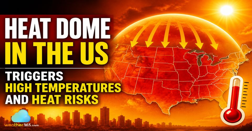
Heat dome in the US
How Hot Will It Get?
Forecasters at the National Weather Service’s Weather Prediction Center expect unusually hot conditions to dominate from the Plains to the Ohio Valley this weekend. The main driver is a strengthening heat dome in the US, created by a powerful upper-level high-pressure system that traps warm air near the surface.
Afternoon temperatures are forecast to reach the 90s across areas as far north as Minnesota and the Great Lakes, while much of Texas could see highs exceeding 100°F. Combined with elevated humidity levels, heat index values may approach 110°F across portions of the Mid-South and central Gulf Coast.
Nighttime temperatures will offer little relief, with some locations potentially setting records for the warmest overnight lows.
The center of the heat dome is expected to remain focused over the Ohio Valley, Tennessee Valley, and middle Mississippi Valley through much of next week. Periodically, the intense heat may spread into the Plains, Great Lakes, Gulf Coast, and eastern states.
Weather experts also warn that hot and humid conditions will intensify along the East Coast by the end of June, with several consecutive days of temperatures well into the 90s possible in major metropolitan areas along the Interstate 95 corridor.
What Is a Heat Dome?
A heat dome is a large area of high atmospheric pressure that causes air to sink and warm as it compresses. These systems can stretch hundreds of miles across and are capable of producing temperatures far above seasonal averages.
The term refers to a persistent high-pressure pattern that effectively traps hot air near the ground, much like a lid on a pot. As the air remains confined, temperatures continue rising, often leading to prolonged and dangerous heat waves. Heat domes can also contribute to drought conditions and increase wildfire risk by drying out vegetation and soils.
What Causes a Heat Dome?
Heat domes form when a strong and stationary high-pressure system settles over a region for an extended period. The sinking air suppresses cloud development and limits cooling rainfall, allowing solar energy to build day after day.
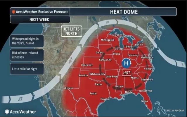
A heat dome is forecast to expand over the central and eastern US
Because these systems can remain in place for days or even weeks, communities beneath them may experience relentless heat that affects people, livestock, crops, and local ecosystems.
How Long Will the Heat Last?
Current forecasts indicate that the central U.S. heat dome may gradually weaken during the second week of July. However, temperatures across parts of the Plains and Midwest are expected to remain above normal even after the most intense heat subsides.
Meteorologists also anticipate that the core of the heat could shift westward by mid-July, bringing elevated temperatures to additional regions.
Will There Be Thunderstorms?
Areas located directly beneath the heat dome are unlikely to experience much thunderstorm activity because the high-pressure system suppresses cloud formation.
However, the outer edges of the heat dome may become active with rounds of thunderstorms. Forecasters are monitoring the potential for severe weather, including damaging winds, heavy rainfall, and localized flooding from the Dakotas through the Upper Midwest and parts of the Great Lakes region late this weekend and into next week.
Tips for Staying Cool During Extreme Heat
Drink plenty of water throughout the day, even if you do not feel thirsty.
Ensure pets have continuous access to fresh water.
Avoid excessive consumption of alcohol, sugary drinks, and caffeinated beverages, which can contribute to dehydration.
Spend as much time as possible in air-conditioned environments.
Take cool showers or baths to help lower body temperature.
Reduce outdoor activities during the hottest hours of the day.
Keep blinds, curtains, or shades closed to block direct sunlight.
Limit the use of ovens and stoves to prevent indoor temperatures from rising.
Wear lightweight, loose-fitting, and light-colored clothing.
Additional Safety Measures
Check on family members, neighbors, and friends who may be vulnerable to heat-related illness.
Never leave children, older adults, or pets inside a parked vehicle, even for a short period.
Seek immediate medical attention if someone develops symptoms of heat exhaustion or heat stroke, including confusion, dizziness, rapid heartbeat, or loss of consciousness.
Related post

Storm in Philadelphia Brings Weather Concerns for World Cup Match
 84
84
 0
0
 4.8
4.8
 22/06/2026

World Cup Fan Fest in Boston Shuts Down Due to Severe Storms
66
0
4.8
19/06/2026

Norway vs Senegal Weather Forecast: Rain, Thunderstorms, and Fog
49
0
4.8
23/06/2026

0 Comment
Leave a comment
Your email address will not be published. Required fields are marked *