




Severe Weather Triggers Widespread Flooding in Northeast US


LONG ISLAND, N.Y. — Torrents of severe storms and tornadoes swept across the region on Thursday, leaving heavy flooding in northeast states, widespread power outages, and submerged roadways in their wake. Here are the latest updates!
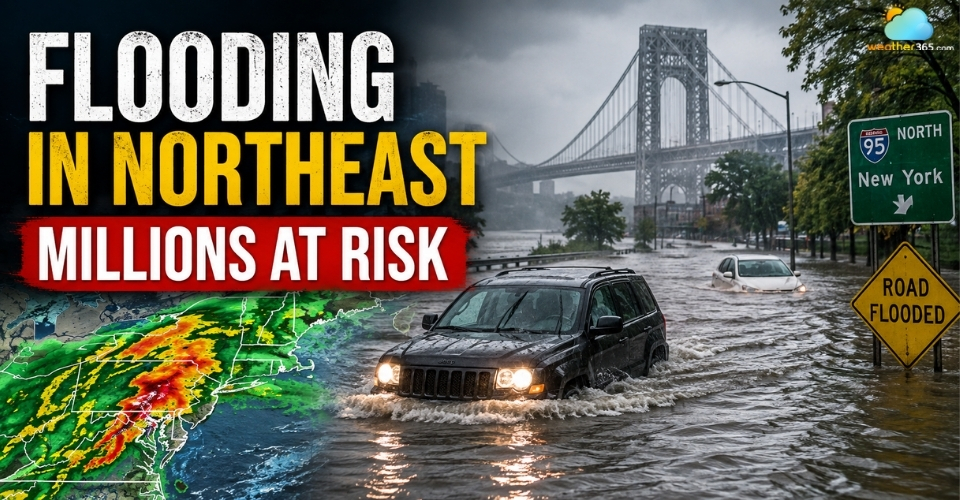
Flooding in Northeast US
Severe Storms Target the Northeast With Heavy Rain
A broad area of the Northeast is facing severe thunderstorms as a cold front pushes east on Thursday, bringing a new round of dangerous weather to major population centers.
More than 38 million people from the New York City area to Washington, D.C., are under the threat of severe storms, with activity expected to build from the afternoon into the evening.
The threat stretches across a large part of the Northeast, from upstate New York and Vermont south to Virginia.
New York City, Philadelphia, Baltimore and Washington, D.C., are among the major cities in the affected area.
Forecasters expect scattered thunderstorms to develop as instability increases ahead of and along the advancing front. (Read more: Types of thunderstorms)
The storm threat is expected to become more active later Thursday, with some storms potentially becoming severe.
The region is under a Level 2 of 5 severe weather risk, while New York City, Philadelphia and Baltimore are also within a lower-level tornado risk area.
Severe weather threat could continue through Thursday evening, making the afternoon and evening the key period to watch as storms move across the Northeast.
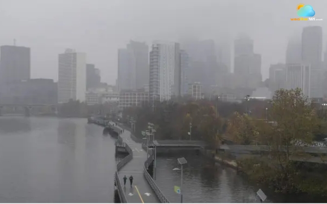
Dark storm clouds gather over the Northeast
Source: FOX Weather
Check the New York hourly weather forecast for rain, wind and changing conditions before you travel.
Flash Flooding Threat Escalates Across Major Cities
More than 25 million people are under Flood Watches from Philadelphia to New York City as heavy thunderstorms raise the risk of flash flooding across parts of the Northeast.
The highest concern is along the corridor from Philadelphia through southern New York, where storms could produce intense rainfall in a short period.
Rainfall rates along the Interstate 95 corridor from New York City to Washington, D.C. could exceed 2 inches per hour.
Some locations could receive as much as 5 inches of rain, increasing the potential for rapid flooding in areas where drainage systems are overwhelmed.
It is estimated that 1 to 2 inches of localized rain could fall through early Friday. Philadelphia is particularly vulnerable after receiving several flash flood warnings this year.
The city had already recorded four flash flood warnings in 2026, including three in August, and rainfall for the month was running more than 1.5 inches above average at the time of the report.
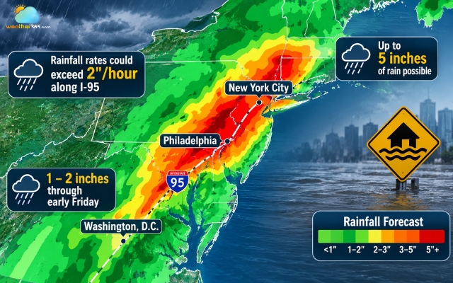
Heavy rain raises the risk of flash flooding across parts of the Northeast
The flooding risk may also be greater in places that have already experienced heavy rain this summer.
Saturated ground can reduce the amount of water absorbed during another burst of intense rainfall, allowing water to collect and rise more quickly.
See the hourly precipitation forecast in Philadelphia to see when rain could become heavier and plan around the latest conditions.
Tornadoes and Damaging Winds Add to the Northeast Threat
Flooding is not the only concern as severe thunderstorms move across the Northeast.
Forecasters are also watching for damaging wind gusts, large hail and isolated tornadoes, particularly across parts of New York, Pennsylvania, New Jersey, Maryland and Virginia.
Some storms could produce wind gusts of 60 mph or stronger.
The tornado threat is relatively limited but could affect several major population centers.
New York City, Philadelphia and Baltimore are among the areas facing a chance of tornadoes as storms strengthen Thursday.
The combination of strong thunderstorms and favorable wind conditions could allow a few storms to rotate and produce brief tornadoes.
The Northeast has already seen several severe weather events this week.
A tornado was reported near Dover, Delaware, while an EF-1 tornado struck near Atlantic Beach on Long Island, with estimated peak winds of 97 mph.
Forecasters will be watching for storms that become more organized as they develop.
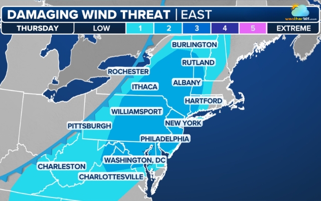
Risk of damaging winds and isolated tornadoes across parts of the Northeast.
Source: FOX Weather
According to CNN, the strongest storms are expected through Thursday evening, with some rain continuing into early Friday morning.
Residents should monitor local Flood, Flash Flood and Severe Thunderstorm Warnings and avoid driving through flooded roads.
If a warning is issued, move to higher ground or a safe indoor location and stay away from windows during severe storms.
Check local forecasts and radar regularly on Weather365 as conditions can change quickly.
Related post
What Causes Thunderstorms? Explore the Science Behind Intense Events
 1586
1586
 8
8
 4.8
4.8
 15/09/2026

Prepare for Flooding: What to Do Before, During, and After a Flood
258
9
4.9
07/09/2026
10 Worst flood in US history - What lessons we can learn from disasters
224
8
4.7
26/08/2026

0 Comment
Leave a comment
Your email address will not be published. Required fields are marked *