



Flash Floods in Southwest Force Evacuations as Rivers Rise to Historic Levels


Heavy rainfall triggered flash floods in Southwest communities across Arizona and Colorado on Sunday, November 1, 2026, forcing mandatory evacuations as rivers and creeks rapidly rose. Emergency crews carried out rescues in affected neighborhoods, while officials in Pagosa Springs warned of potentially catastrophic flooding. More rain was also forecast across parts of the region through Monday.
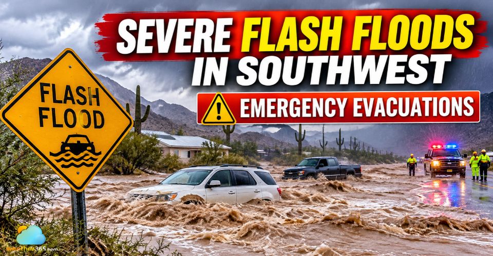
Flash floods in southwest trigger evacuation
Key Updates
Flash floods triggered evacuations across Arizona and Colorado.
The San Juan River threatened to exceed its historic 1911 flood level in Pagosa Springs.
Additional rainfall could worsen flooding across the Southwest through Monday.
Flash Floods in Southwest Trigger Emergency Evacuations
The latest round of heavy rain began Saturday evening and spread across the Southwest, bringing dangerous flooding to several communities.
In Sedona, Arizona, authorities ordered residents near Oak Creek to evacuate after rising water trapped multiple people inside their homes.
At least 100 homes were within the evacuation zone, with nearly 20 requiring emergency assistance to relocate.
Yavapai County and Camp Verde also issued evacuation orders for neighborhoods near swollen rivers and creeks.
Further southeast, officials ordered a full evacuation of Gisela in Gila County, where residents faced flooding along Tonto Creek.
Flooding also affected Tucson, where swift-water rescues were reported.
Emergency response teams used aircraft to help evacuate people from rooftops, while transportation crews worked to clear debris from affected roads.
Several highways across Arizona were closed because of the dangerous conditions.
By Sunday afternoon, rainfall had eased in parts of Sedona, but officials continued monitoring Oak Creek as water levels were expected to peak later in the day.
No injuries or deaths had been reported at that time.
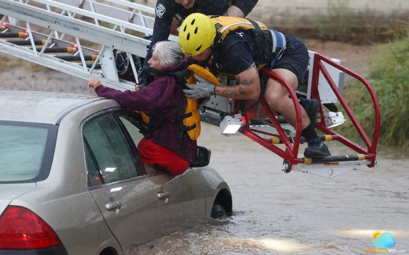
Crews rescue a woman from her car (Photo: Mason Kumet)
Check current rainfall and precipitation intensity in Sedona to monitor changing conditions. However, official evacuation instructions should always take priority over radar information.
San Juan River Threatens Historic Flood Levels
In Pagosa Springs, Colorado, the rising San Juan River became a major concern as officials warned of potentially catastrophic flooding.
The river was forecast to crest at 21.9 feet (6.7 meters) late Sunday night, well above the approximately 17.8 feet (5.4 meters) recorded during the devastating 1911 flood.
Authorities urged people living in low-lying areas along the San Juan, Rio Blanco, Navajo and Piedra rivers to evacuate and seek shelter at a designated local church.
The highway into Pagosa Springs was also closed to inbound traffic, while all public roads in neighboring La Plata County were shut down because of flooding.
Officials additionally warned residents to avoid contact with the San Juan River after sewage was discharged into the water.
Street flooding and the evacuation of downtown businesses added to concerns about access to essential supplies and emergency services.
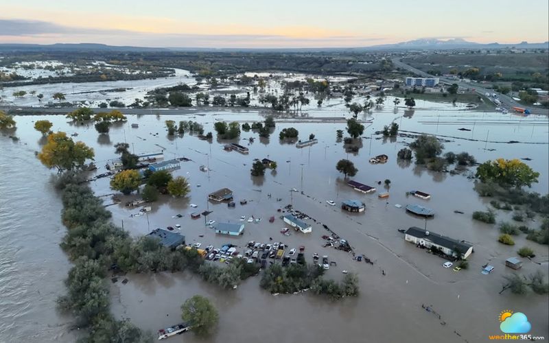
Floodwaters inundate Shiprock as the San Juan River crests (Photo: ABC News)
For localized weather updates, residents can check precipitation, rainfall and wind conditions in Pagosa Springs to follow changing weather patterns around the area.
Flash Flood Risks Persist Across the Southwest
The flooding threat was expected to continue as a series of Pacific storm systems brought additional moisture into the Southwest.
According to the National Weather Service (NWS), some areas could receive up to 4 inches (10 centimeters) of rain, with wet conditions expected to persist through Monday, November 2.
Flood warnings and watches covered nearly all of Arizona, as well as parts of southern Utah, southwestern Colorado, western New Mexico and southern Nevada.
The Four Corners region, where the four states meet, remained among the areas facing significant flood risks.
Previous storms had already saturated the ground, increasing the amount of rainwater flowing into rivers and drainage channels.
This raised the likelihood of further flooding, particularly in low-lying communities and areas with poor drainage.
Backcountry roads could also become impassable as runoff increased.
Although rainfall was expected to ease across parts of Arizona, the weather system was forecast to move eastward, potentially bringing significant precipitation to other areas.
Residents should continue monitoring local weather alerts, avoid flooded roads and never attempt to cross moving floodwater.
Anyone under an evacuation order should leave immediately rather than wait for conditions to worsen.
Flash Flood Safety: What Residents Should Do
|
Learn more on Flood safety tips!
References
AP News
ABC News
WJTV
Related post

Flood Safety Tips: Essential DOs and DON'Ts to Protect Your Family
 292
 8
 4.9
 20/08/2026

Complete Flood Emergency Kit Checklist for Every Household
197
8
4.7
18/08/2026
Record Low Snow in Colorado Triggers Dramatic Glacier Thinning
28
0
4.8
28/10/2026

0 Comment
Leave a comment
Your email address will not be published. Required fields are marked *