




Severe Storms and Flash Flooding South Texas Trigger State Emergency Response


Flash flooding South Texas became a growing concern as heavy rain and severe thunderstorms swept across the region, threatening several communities with dangerous flooding. With some areas recording over 5 inches of rain, state officials mobilized additional emergency resources. Here's what residents need to know about the affected areas and flood risks.

Flash flooding South Texas
South Texas Rainfall Forecast November 8–9, 2026 · Historical event outlook | |
2–5" Expected rainfall Widespread totals | 7–9" Isolated rainfall Locally higher amounts |
1–2" Rainfall rate Per hour in stronger storms | Level 2/4 Flood risk Moderate Risk in earlier outlook |
Areas of concern Corpus Christi Laredo Kingsville Brownsville San Antonio Kerrville | |
Main concern: Rapid flooding in low-lying areas, urban streets and locations with poor drainage. | |
Source: ABC News, National Weather Service and Weather Prediction Center. Figures refer to the November 8–9 forecast period, not current conditions. | |
Flash Flooding South Texas Threatens Regions
South Texas faced an elevated risk of flash flooding as multiple rounds of thunderstorms moved across the region over the weekend and into Monday.
The National Weather Service (NWS) warned that saturated ground from several days of rainfall could increase the risk of rapid flooding, particularly in low-lying areas and locations with poor drainage.
Widespread rainfall totals of 2 to 5 inches were expected across parts of South Texas, while isolated areas could receive 7 to 9 inches through Monday.
Some locations had already recorded more than 5 inches of rain since Sunday morning, particularly between eastern Laredo and areas near Kingsville.
Rainfall rates could also reach 1 to 2 inches per hour during stronger storms, raising concerns about rapidly rising water levels and dangerous road conditions.
The Weather Prediction Center (WPC) placed eastern South Texas under a Level 2 of 4 risk for excessive rainfall on Monday, November 9.
The threat extended across several communities, including Brownsville, Corpus Christi, San Antonio, Laredo and Kerrville.
A combination of an upper-level low-pressure system and unusually moist air from the Gulf of Mexico helped fuel widespread thunderstorms.
Slow-moving storms and repeated rainfall over the same locations further increased the potential for flash flooding.
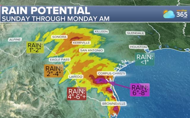
Rainfall forecast in southern Texas Sunday through Monday (Photo: ABC News)
—> 3-day Texas Weather Forecast
Texas Boosts Emergency Response as Flood Risks Rise
As heavy rainfall threatened South and West Texas, Governor Greg Abbott directed the Texas Division of Emergency Management (TDEM) to activate additional state emergency response resources on November 6.
The deployment aims to support local officials and strengthen the state's ability to respond to flooding and potential rescue operations.
Several agencies are involved, including the Texas Department of Transportation, Texas Department of Public Safety and Texas Parks and Wildlife Department.
Available resources include swiftwater rescue teams, rescue boats, high-clearance vehicles, helicopters and emergency medical personnel.
Transportation officials are also monitoring road conditions, while state agencies are coordinating efforts to support communities facing severe weather impacts.
Abbott urged Texans to stay informed about local forecasts, avoid flooded roadways and follow instructions from state and local authorities.
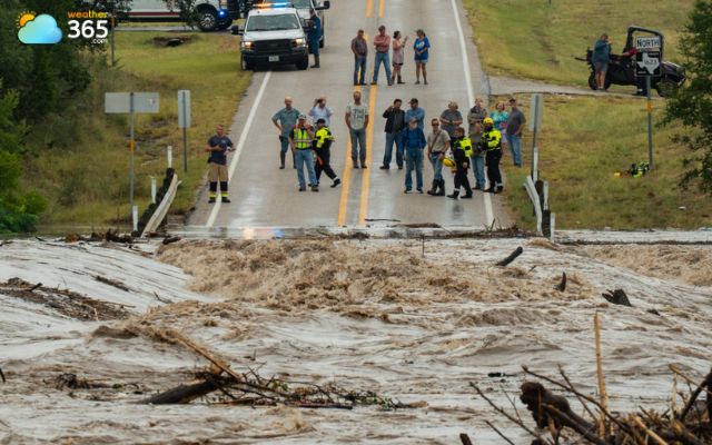
Texas prepares emergency response as flood risks rise (Photo: Mikala Compton)
Although rainfall was expected to gradually ease in some areas by Monday evening, the risk of flooding could persist as saturated ground continued to release excess water into nearby waterways.
Flooding can develop quickly in urban neighborhoods, along creeks and near low-water crossings.
Drivers face particular danger because water depth and road conditions can be difficult to judge, especially at night or during heavy rain.
The NWS advises residents to take precautions when flood risks increase:
Avoid driving or walking through flooded roads, even when water appears shallow.
Stay away from low-water crossings and fast-moving streams.
Monitor official weather alerts and local emergency updates.
Prepare essential supplies and identify higher ground if flooding threatens nearby homes.
Residents should also remember that dangerous conditions may continue after thunderstorms weaken.
Rising waterways and accumulated runoff can create additional hazards downstream, making continued awareness important throughout the recovery period.
For the latest warnings and changing weather conditions, continue monitoring Weather365 Trending News!
References
ABC News
FOX Weather
VOZ US
Demokratis
Related post
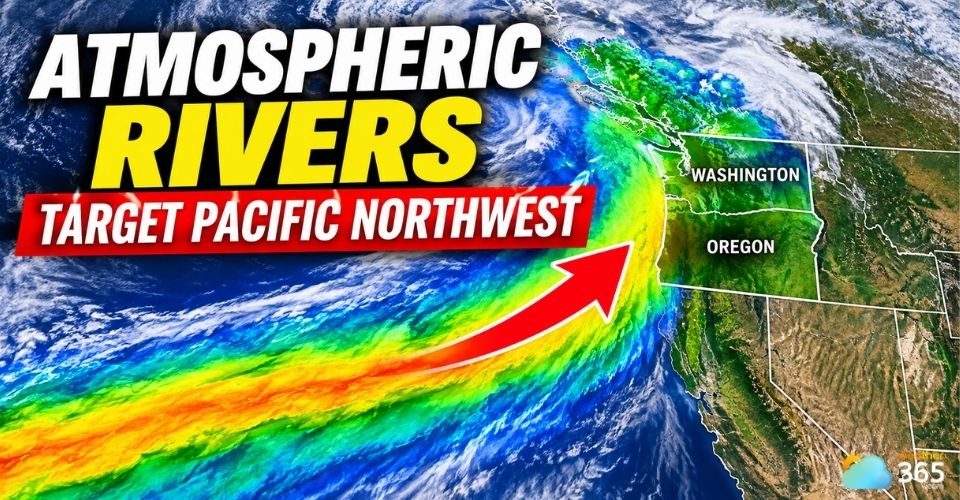
Atmospheric Rivers Pacific Northwest to Bring Heavy Rain and Strong Winds
 357
 0
 4.6
 09/11/2026

Early-Season Northeast Snow Storm Triggers Major Weather Shifts
237
0
4.8
09/11/2026

Iraq Flash Floods Cause Severe Damage Across Erbil
11
0
5.0
10/11/2026

0 Comment
Leave a comment
Your email address will not be published. Required fields are marked *