

Now, Hurricane Kiko surged to a Category 4 storm in Pacific Ocean
Hurricane Kiko intensified into a Category 4 major hurricane in the Pacific Ocean on Wednesday, even as Hurricane Lorena advanced toward Mexico’s Baja California coast.
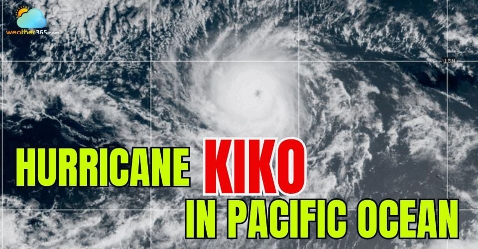
Hurricane Kiko developed into a Category 4 storm
Hurricane Kiko is a Category 4 storm
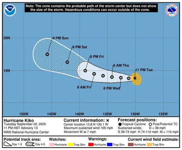
According to the National Hurricane Center (NHC) in Miami, Kiko reached maximum sustained winds of 130 mph (215 kph) on the Saffir-Simpson Hurricane Wind Scale, which ranks storms from 1 to 5, with Category 3 and above considered major hurricanes.
Kiko was located about 1,600 miles (2,580 km) east of Hilo, Hawaii, moving west at 9 mph (15 kph).
Forecasters predict Hurricane Kiko can reach Category 3 strength by late Wednesday and potentially intensify to Category 4 on Thursday before moving into the Central Pacific basin this weekend.
The storm poses no immediate threat to land, and no watches or warnings are in effect.
Hawaii's impacts are expected next week
Impacts from Hurricane Kiko could reach Hawaii by mid-next week, according to AccuWeather. Residents and visitors should prepare for torrential rain leading to possible flooding and mudslides, strong winds capable of causing power outages, and dangerous surf conditions.
“Kiko is forecast to strengthen into a major hurricane later this week as it tracks west toward Hawaii,” said Alex DaSilva, AccuWeather’s lead hurricane expert. “The storm is expected to weaken over the weekend, but if it continues toward the islands, wind and rain impacts could be felt next week.”
Hurricane Kiko is spinning in the Pacific Ocean
As of September 3, the National Hurricane Center reported that no coastal watches or warnings were in effect for Hurricane Kiko.
Hurricane Lorena
Meanwhile, Hurricane Lorena was a Category 1 storm with maximum sustained winds of 80 mph (130 kph).
It was located about 160 miles (225 km) west of Cabo San Lucas, Mexico, moving northwest at 15 mph (24 kph).
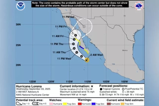
Hurricane Lorena tracker
Forecasters warned that Lorena could continue to intensify through the evening, with the potential to bring up to 15 inches (38 cm) of rain, raising the risk of flash flooding and mudslides in parts of Baja California and northwestern Mexico.
Tropical storm warnings and watches were in effect, and Lorena was expected to weaken to a tropical storm by the time it nears land on Friday.
Besides, the National Hurricane Center is monitoring a tropical wave in the eastern Atlantic, a few hundred miles southwest of the Cabo Verde Islands. Forecasters say conditions favor gradual development, with a tropical depression likely by late week or weekend. Moving west to west-northwest at about 15 mph, the system has a 70% chance of formation within seven days.
>>>>> Stay tuned for Weather365 to update more weather news! <<<<<
Related post

Is Atlantic hurricane season slowing down? Here's what experts say about the delay

Storm Erin may fuel wildfire flames in Atlantic Canada more intensive

0 Comment
Leave a comment
Your email address will not be published. Required fields are marked *