




Heavy Rain Brings Severe Flood Threat in Florida This Week


A relentless flood threat in Florida is escalating this week as a stalled front traps heavy tropical moisture across the state. Several inches of torrential rain will soak cities from the Panhandle to Central Florida through the weekend. Low-lying areas face significant flash flooding and coastal erosion. Here are the latest updates on the multi-day storm setup and 7-day forecast - check now!
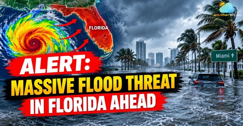
Flood threat in Florida
Flood Threat in Florida: High-Risk Areas
Florida is bracing for widespread flash flooding and prolonged heavy downpours as a slow-moving cold front stalls across the Southeast.
This front is drawing in deep tropical moisture from Central America, while strong high pressure to the north traps the rain band directly over the Sunshine State.
Flood Watches now stretch over 400 miles from Mobile, Alabama, to Jacksonville, Florida, with heavy rain rates reaching 1 to 3 inches per hour.
In addition, a low-pressure system forming off the Atlantic coast is triggering gusty winds up to 40 mph, creating severe threats of coastal flooding, beach erosion, and deadly rip currents.
(Read more: what causes floods)
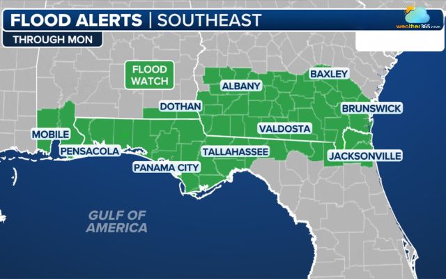
Widespread flood watch issued across low-lying Florida communities (Photo: FOX Weather)
Planning to travel around Duval County or commute along Interstate 10? Be sure to check the live Jacksonville weather conditions before hitting the road.
Emerging Gulf Tropical Threat
Forecasters are also keeping a close eye on the southern Gulf of Mexico and the Bay of Campeche.
A cluster of thunderstorms in this region could slowly organize into a tropical depression or tropical storm later in the week.
Gulf waters are warm enough to support tropical development. However, strong wind shear farther north may limit its overall strength.
Even if a tropical storm does not fully form, the system will send another surge of moisture into the Gulf Coast.
This extra rainfall will keep flash flood risks elevated through the weekend.
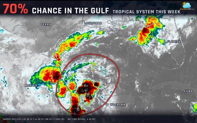
A developing tropical disturbance in the southern Gulf of Mexico (Photo: The Space Coast Rocket)
7-Day Detailed Weather Forecast
Florida faces a soaking week ahead as rain chances remain well above average. Here is the short breakdown for the next 7 days:
Days | Forecast & Key Hazards | Rain Chance / Totals |
Mon–Tue | Afternoon/evening storms, frequent lightning, gusty winds | 60% – 90% (1–3 in/hr localized) |
Wed–Thu | Peak heavy rainfall, widespread flash flooding risk | 2–5 inches (isolated 4–8 inches) |
Fri | Scattered downpours on saturated ground, lingering flood risk | 50% – 70% |
Sat–Sun | Persistent unsettled pattern, scattered showers, highs in mid-80s | 50% – 60% |
For live continuous weather updates across your neighborhood, check the detailed forecast on Weather365!
Essential Safety Tips During Heavy Flooding
Follow these steps to stay safe during a multi-day rain event ahead:
Never attempt to drive through flooded streets, as water can be deeper than it looks.
Keep storm drains near your home clear of leaves and debris to help water drain faster.
Charge your phone fully and keep flashlights nearby in case power outages occur.
Stay out of the ocean due to high dangerous ocean currents along the coast.
Always monitor official local weather alerts for real-time flood warnings in your area.
References
FOX Weather
Tallahassee Democrat
ClickOrlando
Related post

What Are the Worst Floods in History? Look Back at Catastrophic Flooding Events
 597
597
 8
8
 4.7
4.7
 14/09/2026

Flood Safety Tips: Essential DOs and DON'Ts to Protect Your Family
247
8
4.9
20/08/2026
10 Worst flood in US history - What lessons we can learn from disasters
222
8
4.7
26/08/2026

0 Comment
Leave a comment
Your email address will not be published. Required fields are marked *