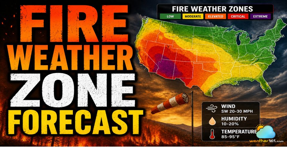
Fire Weather Zone Forecast: Alerts, Zones and Preparedness Tips
A fire weather zone forecast helps identify wildfire risk areas using wind, humidity, drought, and temperature data. It explains how fire weather forecasts support public awareness and emergency response. The guide also shares practical preparedness tips to reduce wildfire risks during severe fire seasons.
Understanding fire weather zone forecast
What is a fire weather zone forecast?
A fire weather zone forecast is a localized weather report that highlights conditions influencing wildfire risk, such as temperature, humidity, wind, and fuel moisture in designated geographic zones.
To understand the most common ignition sources behind these alerts, read what causes wildfires (natural vs human causes).
Issued by the authority agencies, it provides short- to medium-range outlooks (typically 6–10 days) to help firefighters, communities, and land managers anticipate and prepare for potential fire hazards.
Although the fire weather zone forecast is used to predict wildfire risk, each country develops its own forecast system.
If you want the basics first, see what is a wildfire (definition + types).
Canada: Fire weather index (FWI) system
In Canada, the fire weather zone forecast is based on the Canadian Forest Fire Weather Index (FWI) System, which provides daily updates on wildfire danger levels.
Using data from Environment and Climate Change Canada and Natural Resources Canada, the system evaluates key factors such as temperature, humidity, wind speed, and precipitation.
It also incorporates specialized indices like the Fine Fuel Moisture Code (FFMC) and the Drought Code (DC) to assess how dry vegetation and deeper fuel layers are, both of which are critical for predicting wildfire behavior.
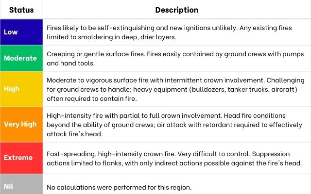
The forecast rates fire danger on a scale from “Low” to “Extreme”.
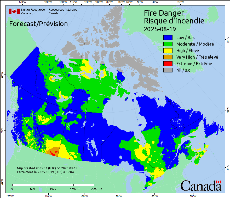
Fire weather map in Canada (2025-08-19)
These ratings are updated daily and are accessible through the Canadian Wildland Fire Information System (CWFIS), which provides interactive maps and regional outlooks.
By following Canada’s fire weather zone forecasts, residents can stay informed about wildfire risks in their area and take timely precautions to protect lives and property, especially during the Canada wildfire season.
United States: NWS & SPC Zones
In the United States, the National Weather Service (NWS) issues the fire weather zone forecast and provides detailed wildfire risk assessments for specific geographic zones.
Each zone is identified by a code (for example, “CAZ272” in California, OR696 in John Day Valley, Oregon).
The zone forecast includes localized forecasts of temperature, humidity, wind speed, and precipitation, along with alerts such as Red Flag Warnings when dangerous fire conditions are expected.
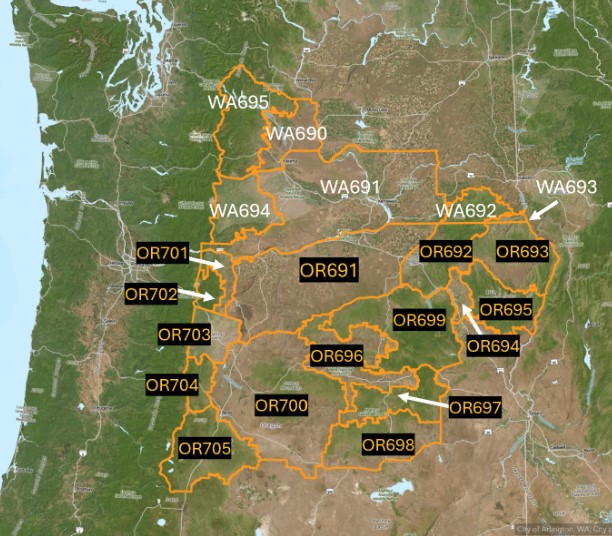
Fire weather zones and names in US (2025)
In addition to zone-based forecasts, the Storm Prediction Center (SPC) issues national Fire Weather Outlooks to highlight areas at Elevated, Critical, or Extremely Critical risk of wildfire spread.
These outlooks also cover threats from dry thunderstorms, which can ignite fires without producing significant rainfall.
By combining local zone forecasts with national outlooks, the U.S. system gives firefighters, emergency managers, and residents a comprehensive picture of wildfire danger.
Following these fire weather zone forecasts helps communities prepare early, respond effectively, and reduce the risks posed by fast-changing fire conditions.
You may also like this:
Australia: Fire Behavior Index (FBI)
In Australia, the fire weather zone forecast is an essential tool for predicting and managing bushfire risks across the country.
Issued by the Bureau of Meteorology (BOM), these forecasts assess critical weather conditions such as temperature, wind speed, relative humidity, and rainfall to determine the likelihood of dangerous fire behavior.
Unlike general weather forecasts, fire weather zone forecasts are tied to Fire Danger Ratings (FDR), which range from Moderate to Catastrophic.
0 - 11: no rating
12 - 23: Moderate
24 - 49: High
50 - 99: Extreme
100+: Catastrophic
These ratings are updated daily and help authorities, land managers, and residents understand the potential fire threat in their district or region.
When conditions become severe, the BOM issues Fire Weather Warnings, prompting communities to activate safety plans and avoid activities that could spark a blaze.
The Australian Bureau of Meteorology (BOM) issues fire weather forecasts and ratings for multiple regions.:
Fire Weather District | District Rating | Fire Behaviour Index (FBI) |
Wyndham-East Kimberley | Moderate | 13 |
Derby Coast | Moderate | 17 |
Sandstone | High | 43 |
Gascoyne Inland | High | 38 |
Karratha | High | 24 |
Esperance | No rating | 11 |
Fire Weather Forecast for Western Australia (Updated 2025-08-19)
Read more: How did Australia fires start?
European countries
In Europe, wildfire risk is monitored through the European Forest Fire Information System (EFFIS).
This system provides regional fire weather danger forecasts across EU member states and neighboring countries.
Unlike the localized zone forecasts used in the U.S. or Canada, EFFIS produces harmonized fire danger maps using indices from the Canadian Fire Weather Index (FWI) System, ensuring consistent ratings across different climates and terrains.
The fire weather zone forecast in Europe highlights daily and multi-day fire danger levels, ranging from low to very extreme, based on variables such as temperature, humidity, wind speed, and precipitation.
These forecasts are updated regularly and displayed on interactive maps that allow authorities, firefighters, and the public to monitor changing wildfire risks across borders.
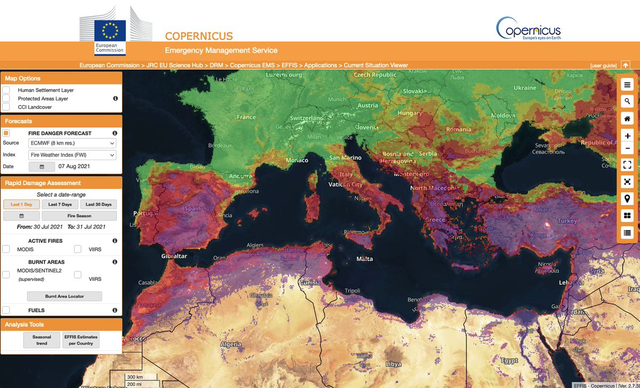
The European Forest Fire Information System
Purposes of the Fire Weather Zone Forecast
The fire weather zone forecast plays a vital role in protecting communities, natural resources, and lives by providing detailed insight into wildfire risks.
Unlike general weather reports, these forecasts focus specifically on the conditions that influence fire ignition and spread, offering both local and global perspectives.
Public Awareness
Fire weather forecasts keep residents informed about daily fire danger levels.
By checking updates on official meteorological and emergency management websites, such as the National Weather Service (NWS) in the U.S. or the Bureau of Meteorology (BOM) in Australia, communities can prepare to reduce fire-starting risks and stay alert for warnings or evacuation notices.
If your area is smoky or under warnings, see wildfire smoke health effects (symptoms + protection tips) for practical protection steps.
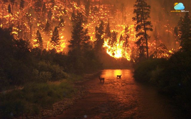
Prepare for the fire season
Prevention & Response
Accurate fire zone forecasts guide crucial safety measures, including burning restrictions, evacuation planning, and firefighting resource allocation.
Emergency services rely on these forecasts to position crews, manage equipment, and coordinate community safety actions during critical fire weather days.
Planning also depends on how long events can persist—see how long can a forest fire last (duration + factors).
Global Context
On a wider scale, tools like the Global Wildfire Information System (GWIS) integrate multiple forecasting models to provide a global map of fire danger classes, from Low to Very Extreme.
This international approach helps track wildfire risks across borders, supporting cooperation between countries and organizations in wildfire management.
For a country-by-country view of major wildfire hotspots, see what country has the most wildfires (global hotspots).
Fire weather zone forecast helps track wildfire risks across borders
Fire Weather Preparedness Tips
Being prepared for fire weather conditions can make a critical difference in reducing wildfire risks and ensuring safety.
Follow these fire weather preparedness tips to stay ready:
Monitor forecasts daily: Check your local fire weather zone forecast and stay updated on Red Flag Warnings or fire danger ratings.
Create defensible space: Clear dry leaves, branches, and flammable materials within at least 30 feet of your home to slow fire spread.
Prepare an emergency kit: Include essentials such as water, non-perishable food, medications, important documents, and communication devices.
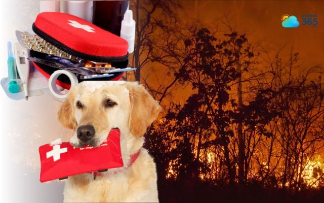
Prepare an emergency kit
Plan evacuation routes: Know at least two ways out of your neighborhood and share the plan with family members.
Avoid risky activities: Refrain from outdoor burning, welding, or using machinery that can spark during high fire danger days.
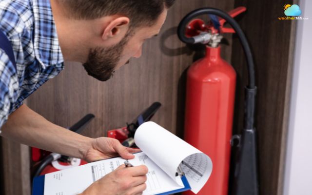
Maintain fire equipment: Keep hoses, shovels, fire extinguishers, and tools accessible in case of small spot fires.
Stay connected: Sign up for local emergency alerts and follow updates from official agencies like the National Weather Service (NWS), Bureau of Meteorology (BOM), or regional fire authorities.
By following these fire weather preparedness tips, you can minimize wildfire risks, protect your property, and ensure the safety of your family and community.
Conclusion
By monitoring fire weather zone forecast daily updates, following safety guidelines, and acting on official warnings, communities can reduce fire danger and protect lives, property, and natural landscapes. Whether you live in the U.S., Canada, Australia, or Europe, checking your local fire weather zone forecast ensures you are always ready for changing fire conditions.
(Terminology note) If you’re comparing regional usage, see difference between wildfire and bushfire (terminology by region).
Frequently Asked Questions (FAQs)
Related post

How to prevent wildfire: Complete Guide to Fire Risk Reduction

What Causes Wildfires? Primary Environmental & Human Factors

0 Comment
Leave a comment
Your email address will not be published. Required fields are marked *