

Western Maryland flooding: More than 100 rescue calls in 2 hours
On Saturday, severe flash flooding impacts Western Maryland. There are over 100 rescue calls within a mere two-hour window, which is an emergency volume that typically occurs over an entire day.
The area, located just north of Washington, D.C., was battered by intense rainfall from a powerful storm system that caused rapid and severe flash flooding.
Unprecedented flooding in Western Maryland
In key areas such as Silver Spring, Maryland, and Great Falls, Virginia, water levels rose rapidly, leaving many residents temporarily unable to leave buildings and vehicles.
In response to the severity of the situation, the National Weather Service issued a historic flash flood emergency alert for Silver Spring and its surrounding regions.
This alert, the most critical flood warning available, had never before been issued in the D.C. metropolitan area since it was introduced in 2003.
Flood sensors along Sligo Creek recorded water levels rising by as much as 10 feet within just 30 minutes.
Rainfall measurements throughout the region showed significant variation but consistently high amounts falling in a very short span:
-
Tacoma Park received between 2.5 and 3.5 inches of rain;
-
Silver Spring recorded 3.5 to 4.5 inches;
-
Chevy Chase saw up to 2.5 inches;
-
Great Falls experienced as much as 3.5 inches.
Although these totals might not seem remarkable at first glance, the rapid accumulation in roughly 1-1.5 hours resulted in an overwhelmingly intense rain rate.
It overwhelmed local drainage systems and waterways.
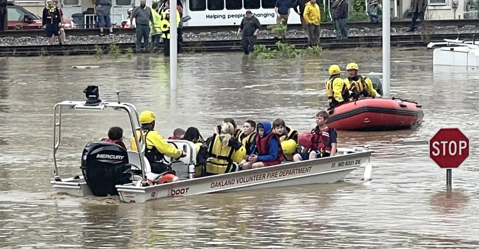
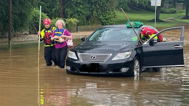
The Western Maryland flooding prompted dozens of water rescue operations throughout the evening.
In one incident, approximately 20 individuals inside a Chevy Chase building sheltered in place until officers guided them out safely through an alternate route several hours later.
Rescue 20 trapped inside the Chevy Chase building
In another incident on Sligo Creek Parkway, a resident reported that his wife and daughter’s SUV became stranded as floodwaters rose quickly, but neighbors assisted in helping them reach safety.
Fortunately, quick-acting neighbors assisted in evacuating them to safety before the situation worsened.
Long-term residents noted that the flooding was unusually severe compared to previous events in the area.
As of Sunday morning, several critical roads, including Sligo Creek Parkway, remained closed due to floodwaters and damage to infrastructure, complicating travel and recovery efforts in the region.
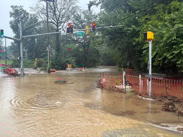
Sligo Creek Parkway remained closed due to floodwaters
While the National Weather Service lifted the flash flood emergency alert by 9 p.m. Saturday, officials cautioned that the threat of flooding remains significant.
Forecasts indicated lighter showers over the following days, but meteorologists warned of a potential resurgence of thunderstorms late in the week, which could bring further heavy rains and localized flooding.
This event highlights how quickly flash floods can develop and underscores the importance of following emergency alerts, evacuation guidance, and community preparedness.
Follow Weather365 to update more latest weather news!
Related post

0 Comment
Leave a comment
Your email address will not be published. Required fields are marked *